The proposition that green landscapes promote human health and well-being is widely accepted and supported by extensive empirical evidence. However, this consensus is often interpreted in an overly simplified way, as if “Greener is better”, regardless of landscape type, user characteristics, social, cultural, and historical context. Such a one-size-fits-all understanding risks obscuring important disparities and unintended harms. In response to this concern, this study seeks to develop a more nuanced comprehension of the relationship between green landscapes, health, and well-being. Specifically, we aim to identify the conditions under which green landscapes may not only confer benefits but also produce limited, ambiguous, or even negative impacts on public health well-being, thereby challenging overly generalized claims in both research and practice.
This study adopted a multi-step, empirical evidence-informed narrative review strategy. First, we conducted a thematic analysis of empirical and conceptual studies published mainly in the last 25 years in peer-reviewed journals indexed in Web of Science, Scopus, ScienceDirect, and related databases. The search strategy focused on the relationship between green landscapes and health or well-being, with attention to negative outcomes. Guided by an initial scoping of the literature, we identified three intersecting analytic dimensions as central: 1) biodiversity within green landscapes (e.g., species richness, vegetation and wildlife diversity, ecological restoration); 2) socioeconomic, demographic, and cultural characteristics (e.g., gender, age, income, education, ethnicity, migration status, and cultural norms); and 3) perceived safety (e.g., visibility, spatial enclosure, maintenance, crime risk, and gendered experiences of fear). Second, we applied a structured coding scheme during the full-text review to extract information on environmental settings, types and spatial configurations of green space, biodiversity indicators, social and demographic variables, safety-related attributes, and health and well-being outcomes. Third, we synthesized the findings narratively across the three dimensions, with particular emphasis on identifying types of green landscapes and contextual conditions under which negative effects on health and well-being are most likely to occur.
The analysis indicates that the relationship between green landscapes and health and well-being is strongly context-dependent rather than uniformly and universally positive. Higher levels of biodiversity are frequently associated with greater psychological restoration, aesthetic appreciation, and a stronger sense of connectedness to nature. However, under certain conditions biodiversity can also increase health risks. Inappropriate species selection and planting design may elevate allergenic pollen loads and exacerbate respiratory problems, while dense vegetation and overlapping human−wildlife habitats can facilitate human−animal conflicts or support disease vectors and pathogens. In addition, visually “messy”, enclosed, or overgrown vegetation is often perceived as neglected or unsafe, thereby reducing perceived safety and discouraging use. Socioeconomic, demographic, and cultural characteristics further mediate who accesses, uses, and benefits from green landscapes. Gender, age, income, education, and cultural background shape both reliance on nearby green spaces and sensitivity to their design, accessibility, and informal surveillance. Women and elderly often depend more on proximate green areas but are also more affected by deficits in these qualities. More affluent groups typically enjoy greater proximity to high-quality green environments and have more leisure time to use them, whereas disadvantaged populations face educational, spatial, temporal, and cultural barriers and may be exposed to green-led gentrification, displacement, and isolation. As a result, the health benefits and risks associated with green spaces are unevenly distributed and may reinforce existing social and health inequalities. Finally, perceived safety is a critical contextual factor. Poor lighting, dense and visually obstructive vegetation, secluded paths, degraded facilities, and a lack of amenities, management, and active functions are associated with lower perceived safety and, in some contexts, higher crime risks. In certain neighborhoods, parks are linked to gang activity or gender-based violence, particularly deterring women and other vulnerable groups. Socio-racial dynamics and cultural beliefs can further transform potentially restorative environments into “scary spaces,” generating fear, anxiety and avoidance rather than health benefits.
The widely accepted proposition that “green landscapes promote human health and well-being” is, in general, valid. Our intention is not to challenge this important consensus, but rather to develop a deeper, more comprehensive, and more nuanced understanding of this issue. However, the effects of green landscapes need to be assessed more precisely from several perspectives. First, green landscapes encompass multiple types, and different kinds of green space may have distinct health effects, each with its own strengths and limitations. Second, the “people” served by green landscapes are themselves highly heterogeneous and should not be treated as a single, undifferentiated population group; the social, economic, demographic, and cultural characteristics of specific target populations should be fully taken into account. Third, we may need to adopt more non-linear and non-binary modes of thinking: the impacts of green landscapes on health and well-being are not a simple black-and-white issue. Fourth, we should be cautious about an absolutist anthropocentric perspective and give due weight to the broader effects of green space, especially its ecological effects. We argue that the various positive effects of green landscapes are likely to be coupled, and that these coupled effects constitute an important topic for future in-depth research. Finally, it should be emphasized that this study is a narrative review, which cannot quantify the number, proportion, or interrelationships of the different types of issues discussed. We look forward to future reviews that are more systematic and quantitative to further elucidate these questions. We hope this study can provide some new ideas for future research and practice on the health and well-being effects of green landscapes.
To clarify how urban visual environments influence human responses, this study reviews empirical evidence on urban visual landscape indicators and their effects. Urban visual environments play an important role in people-oriented urban development and healthy city planning. Street-view imagery, semantic segmentation, and computer vision now support large-scale measurement of human-scale visual exposure. Common indicators include green view index, visible sky ratio, visible building ratio, visible water ratio, enclosure, and openness. However, existing studies use different definitions, data sources, spatial scales, statistical models, and response variables. Their findings often differ in effect direction and strength. This limits comparison across studies and weakens their value for planning practice. To address this problem, this study constructs an “urban visual landscape-human response” analytical framework. It aims to identify the evidence distribution, effect direction, contextual differences, and vegetation-related mechanisms of urban visual landscape effects.
This study followed the PRISMA framework. We searched the Web of Science Core Collection, Scopus, and CNKI databases for empirical studies published from January 2016 to January 2025. After screening titles, abstracts, and full texts, we included 119 studies. We standardized and coded visual indicators and human response variables. Urban visual landscape indicators were divided into four groups: color and lighting features, landscape elements, spatial form, and landscape imagery. Human responses were divided into six groups: restoration and stress, emotional and psychological states, safety and risk perception, aesthetic and preference evaluation, perceived comfort and environmental quality, and behavioral responses and use of space. To improve comparability, we unified effect directions. A positive effect means that a visual indicator relates to a more favorable human response. A negative effect means that it relates to a less favorable response. We used vote counting based on effect direction to summarize the overall pattern. We also calculated a net direction index for each visual indicator. Stratified analyses by landscape type and evidence quality tested the robustness and contextual boundaries of the findings. In addition, vegetation-related indicators had the largest evidence base. Therefore, we conducted a random-effects meta-analysis to compare visible vegetation ratio, species richness, structural diversity, and color diversity.
Results show that current research on urban visual environments is uneven. Existing studies mainly focus on landscape elements and spatial form. Color and lighting features and landscape imagery receive less attention. Among all indicators, visible vegetation index is the most frequently studied variable. It far exceeds visible sky ratio, visible building ratio, visible water ratio, enclosure, and openness. This pattern reflects the strong influence of street-view imagery and semantic segmentation methods. Different visual indicators show distinct relationships with human responses. visible vegetation index shows a stable positive association across response categories, landscape types, and evidence quality levels. Its net direction index is 0.73−0.74. Visible building ratio shows a relatively stable negative association. Its net direction index is −0.43. These two indicators act as relatively stable object-based visual cues. Vegetation usually conveys naturalness and restorative qualities. Buildings often convey artificiality, density, and visual pressure. Other indicators show stronger context dependence. Visible sky ratio, visible water ratio, enclosure, and openness do not show a single consistent direction. Their effects vary across landscape types and response categories. This indicates that their influence depends on spatial organization, scene type, and the specific human response being studied. The stratified analysis further shows the contextual boundaries of visual landscape effects. visible vegetation index relates positively to human responses in streets, residential communities, parks, urban green spaces, waterfront areas, and blue-green corridors. Visible building ratio generally relates to less favorable responses across contexts. In contrast, visible sky ratio may show positive effects in residential and waterfront settings, but negative or mixed effects in street spaces. Enclosure and openness also show mixed directions. These findings suggest that stable semantic cues and context-dependent spatial cues coexist in urban visual landscape effects. The vegetation-focused meta-analysis shows that vegetation effects should not be simplified as “more greenery is always better.” visible vegetation index represents the quantity of visual green exposure. It shows broad positive effects across several response dimensions, especially perceived comfort and environmental quality, aesthetic and preference evaluation, behavioral responses and use of space, restoration and stress reduction, and emotional and psychological states. Vegetation quality indicators show more specific effects. Structural diversity relates strongly to emotional restoration, with a pooled correlation coefficient of r = 0.715. Species richness relates closely to perceived environmental quality, with a pooled correlation coefficient of r = 0.646. Color diversity relates more closely to restoration experience and aesthetic evaluation. These results show a hierarchical relationship of “quantity exposure-quality experience-response differentiation”.
This study provides a systematic synthesis of empirical evidence on urban visual landscapes and human responses. The findings indicate thaturban visual landscape effects are not fully linear or fully consistent. Stability and context dependence coexist. Visible vegetation and visible buildings are relatively stable visual cues. Sky visibility, water visibility, enclosure, and openness are more context-sensitive indicators. Based on these findings, we suggest that planning practice should avoid simple one-directional optimization of visual indicators. Urban greening strategies should not only increase visible vegetation coverage. They should also improve species richness, structural diversity, and color variation. Context-dependent indicators should be adjusted according to specific spatial settings and response targets. Overall, this study offers a reusable analytical framework for urban visual environment research and evidence-based implications for health-oriented urban planning and landscape design.
Allergic diseases are immune-related diseases, and their incidence rate is increasing. The decrease in the contact between natural environment and biodiversity caused by the decline of global ecological environment quality is an important factorfor their high incidence. As an important part of the ecosystem, green space is an important carrier facilitating contact between natural environment and biodiversity, and its impact on allergic diseases is increasingly concerned. A deep understanding of the relationship between green space biodiversity and allergic diseases can not only provide a theoretical basis for exploring the relationship between cities, ecology, and health in the process of rapid urbanization, but also provide a practical approach for improving the ecological environment quality of national land and improving health service functions.
Based on literature retrieved from Web of Science and PubMed up to 2025, this review selected empirical studies examining the relationship between green space, its biodiversity, and allergic diseases. A systematic synthesis was conducted to summarize research methods, findings, and underlying mechanisms concerning the impact of green space and its biodiversity on allergic diseases.
Firstly, in terms of research methods, a total of 16 studies used cohort analysis, 12 studies used cross-sectional analysis, and 2 studies used case-control designs. These documents reveal a correlation between green space biodiversity and allergic diseases. Cohort studies, using long-term time-series data, can reveal the cumulative effects of biodiversity on allergic diseases to some extent. However, such studies mainly focus on the macro-level supply characteristics of green spaces, and the measurement of biodiversity is still relatively coarse. Moreover, there is limited empirical evidence on the impact of microbial diversity as the mediating factor. Cross-sectional studies can analyze the comprehensive impacts of demographic, socioeconomic, and environmental factors on allergic diseases by incorporating more refined green space biodiversity indicators and more comprehensive control variables. However, they cannot distinguish causal temporal relationships. Case-control studies have time and economic cost advantages compared to cohort studies. However, current case-control studies have included only availability and accessibility indicators that reflect the overall characteristics of green spaces, and have not provided clear or specific measurements of green space biodiversity. Secondly, the analysis of the impact results shows that there are certain differences in the results. Indicators related to plant diversity and tree species composition are associated with a reduced risk of allergic diseases, while indicators related to grasslands, coniferous trees, and non-native plants are associated with an increased risk of allergic diseases. However, there are significant differences in the research conclusions of indicators reflecting overall supply characteristics. The inconsistency of research conclusions may mainly be caused by differences in research design, exposure assessment, control variables, and geographical regions. Thirdly, in terms of influencing mechanisms, the impact mechanism of green space biodiversity on allergic diseases may stem from its key role in maintaining ecological community stability and preventing species imbalance. The existing theoretical hypothesis has jointly revealed the basic relationship between green space biodiversity and allergic diseases: under the background of urbanization, the environmental and lifestyle changes, the reduction of macro-biodiversity and of human contact with green space and other natural environments and biodiversity, which led to the reduction of microbial diversity contact level, hinders immune regulation circuits, and leads to a sharp rise in the incidence rate of allergic diseases. Appropriate environmental microbial exposure can be achieved by restoring urban green spaces, potentially reducing the incidence of allergic diseases may be reduced. However, the role of green space biodiversity in maintaining community species balance, preventing microbial dysbiosis, and inhibiting single species dominance, as well as the empirical verification of the mediating role of microbial diversity between macro biodiversity and allergic diseases, are not sufficient.
The exiting studies have deficiencies in the measurement of green spaces and their biodiversity indicators, the exploration of complete influence paths and mechanisms. The research on the influence mechanism is a significant gap, and the research conclusions are heterogeneous. Future research can focus on the differentiated roles of fine-grained green spaces and their biodiversity indicators, explore the regulatory effect of green space biodiversity on the balance between species, analyze the key mediating role of microbial diversity, and pay attention to environmental and population differences.
As a crucial component of the human living environment, soundscape quality directly impacts users’ environmental experience as well as physical and mental health. Its positive effects in alleviating mental stress, improving emotional states, and facilitating cognitive recovery have been widely recognized. Bird vocalizations, as one of the most distinguishable and positively valenced elements in natural soundscapes, are not only regarded as key acoustic signals in ecological environments but also considered an important medium connecting humans with nature and promoting public mental health. Moreover, avian biodiversity may exert potential impacts on human restorative experiences by regulating the diversity and loudness characteristics of soundscapes. Clarifying the dose-response relationship between the richness of different bird vocalizations and psychological restorative outcomes constitutes a vital step in advancing soundscape design from qualitative description to scientific quantification.
Three types of bird vocalizations with varying richness levels were selected as experimental stimuli: continuous singing of a single bird species, alternating calls of 5 bird species, and alternating calls of 9 bird species. A 60-second audio clip was extracted from each group to serve as restorative sound materials for the experiment. Stimuli were compiled and randomly presented via ErgoLAB software. For physiological data collection, electroencephalography (EEG) was employed to provide objective physiological evidence. Psychological data were assessed using the Perceived Restorativeness Soundscape Scale (PRSS) and the Profile of Mood States (POMS). A total of 54 healthy adult participants were recruited online. First, participants were fitted with EEG recording equipment and signal calibration was performed. Subsequently, baseline data were recorded under a resting state. After that, participants were exposed to 2 minutes of urban environmental noise stimulation. In the recovery phase, three types of acoustic stimuli with different avian species richness levels were randomly presented, and participants’ physiological and psychological responses were measured. The experimental module structure was consistent across all richness conditions: it began with a 2-minute silent adaptation period, followed by a 1-minute playback of the corresponding bird vocalization stimulus. Upon completion of stimulus playback, participants were required to complete the POMS and PRSS.
After preprocessing all EEG data, valid data were obtained from 52 participants. Compared with urban noise, the bird vocalization environment significantly enhanced the psychological restorative effect. When comparing the restorative differences among the three bird vocalization groups with varying richness levels, the average relative power of different frequency bands across brain regions was calculated: the 9-species group showed higher α wave power.PRSS and POMS analysis showed that under the single bird species condition, 9 of the 12 PRSS items achieved the highest scores, showing a trend that simplicity is superior to complexity. All negative mood scores of POMS were below 2.1, indicating that the overall negative emotional level in the birdsong acoustic environment was low. The negative emotions increased slightly with a greater number of birds. Combining subjective restorativeness scores and physiological regulatory effects, one bird sound yielded the strongest subjective restoration, while nine bird sounds produced the strongest physiological restoration for the brain, followed by one bird. However, nine or more species resulted in reduced restorative effects due to information overload. Spearman correlation analysis among PRSS, POMS subjective scale scores, and EEG data revealed the following relationships: stronger perceived soundscape compatibility was associated with lower δ wave relative power; greater curiosity about the sound was linked to lower θ wave relative power; higher levels of fatigue experienced by participants correlated with higher α wave relative power; and stronger perceptions of soundscape compatibility and "being away" were associated with higher β wave relative power. Certain EEG physiological indicators were correlated with specific dimensions of subjective perception. A degree of dissociation was observed between some EEG indicators and subjective experiences: high-richness bird vocalizations may be more effective in inducing physiological relaxation in the brain; although they did not trigger negative physiological stress responses, they increased information processing load, leading to a decline in subjective restorative experiences.
This study adopted a dual research paradigm combining “objective physiology + subjective experience”. By integrating multi-frequency, multi-brain region EEG analysis with standardized scales (PRSS, POMS), it avoided the limitations of a single research perspective and enhanced the reliability and comprehensiveness of the results. Focusing on avian vocalization richness as a key variable, this study systematically explored the differential effects of varying richness levels and attempted to identify specific quantitative ranges, aiming to provide directly applicable parametric basis for landscape design. Future research can be further expanded in the following aspects: expanding the type and scope of samples to include participants of different ages, occupations, and geographical regions to verify the generalizability of the avian vocalization richness effect; extending research scenarios to explore the interaction between scene characteristics and avian vocalization richness in combination with different landscape types, thereby improving the contextual adaptability of research results; and deepening research variables by introducing acoustic indices, bird vocalization types, and other variables to investigate the soundscape restorative effect under the synergistic action of multiple factors.
Biodiversity perception is an important way for the public to achieve psychological restoration and well-being in urban green spaces. Existing studies have shown that compared to objective biodiversity indicators, perceived biodiversity has a more direct predictive effect on restorative experiences, positive emotions, and place satisfaction, and may play a mediating role between objective biodiversity and psychological well-being. However, the existing measurement tools have multiple limitations: in terms of measurement methods, early studies mostly required respondents to estimate the number of species, which actually measured ecological knowledge and counting ability rather than actual perceptual experience, with high cognitive load and limited data validity; in terms of measurement tools, domestic studies mostly used a small number of items for measurement, with inconsistent dimension divisions, insufficient reliability and validity tests, and lack of comparability among studies, and direct use of foreign scales faces the risk of cultural adaptation. Overall, there is still a lack of a localized perceived biodiversity scale that has been systematically developed and tested with a clear dimensional structure in China. This study aims to develop and validate the Perceived Biodiversity Scale in urban green spaces of China, with the goal of shifting the measurement focus from the judgment of species numbers to the evaluation of on-site experience based on perception cues, providing standardized tools for the assessment of urban green space ecological experiences, health and well-being research, and public natural perception evaluation.
This study is based on the attention restoration theory and stress reduction theory, defining perceived biodiversity into four dimensions: perceived plant diversity, perceived animal diversity, perceived habitat heterogeneity, and perceived naturalness. Firstly, an initial item pool was constructed through literature deduction, and 7 interdisciplinary experts with backgrounds in urban ecology, landscape architecture, and environmental psychology were invited for content validity assessment. Items with ambiguous expressions or overlapping concepts were eliminated based on the item-level content validity index (I-CVI). Subsequently, a pre-survey was conducted among 36 participants through focus group interviews to identify semantic ambiguities and simplify professional terms, resulting in a pilot scale consisting of 22 items. The empirical investigation selected 6 typical urban parks covering different urban zones and biodiversity gradients in Chengdu as sample sites, and conducted an on-site questionnaire survey among 299 park users. Items were rated on a 7-point Likert scale. In the data analysis stage, exploratory factor analysis (EFA), confirmatory factor analysis (CFA), and reliability, convergent validity, and discriminant validity tests were used to systematically verify the scale structure.
Exploratory factor analysis showed that the KMO value was 0.930, the Bartlett’s test of sphericity was significant (p < 0.001), and four factors were extracted, with a cumulative variance explanation rate of 71.31%. The factor loadings of each item ranged from 0.574 to 0.831. In the confirmatory factor analysis, after eliminating two items with standardized factor loadings below the 0.500 threshold (VC4 “places with vegetation cover” and VD3 “traces of neatly trimmed artificial landscape”), the model demonstrated an acceptable fit (χ2/df = 3.070, RMSEA = 0.079, CFI = 0.924, TLI = 0.910). The final scale consists of 20 items from four dimensions: perceived plant diversity, perceived animal diversity, perceived habitat heterogeneity, and perceived naturalness. In terms of reliability, the Cronbach’s α coefficient of the full scale was 0.937, and the α coefficients of each dimension ranged from 0.775 to 0.929. In terms of convergent validity, the average variance extracted (AVE) for each dimension ranged from 0.65 to 0.79, and the composite reliability (CR) ranged from 0.78 to 0.93, all meeting the recommended standards. In terms of discriminant validity, according to the Fornell-Larcker criterion, the square roots of the AVE for each dimension were all greater than their correlation coefficients with other dimensions, and the four dimensions had good statistical independence.
The Perceived Biodiversity Scale in urban green space constructed in this study has a clear four-dimensional structure and good psychometric performance, and can effectively measure the public perception of biodiversity. The research results reveal that the public’s judgment of urban green space biodiversity mainly unfolds along four paths: plant visual characteristics, animal activity cues, habitat structural complexity, and natural growth state. This is a multi-dimensional comprehensive evaluation based on directly perceivable environmental cues. This scale shifts the measurement of perceived biodiversity from specialized species estimation to public experience evaluation, providing standardized tools for urban green space ecological experience assessment, health benefit research, and public natural perception evaluation. At the same time, it can be used in conjunction with objective biodiversity data to identify deviations between ecological construction effectiveness and public perception experience. The limitations of the study lie in the sample source being adult park users in Chengdu and data collection being concentrated in a single season. The applicability of the scale in different regions, seasons, and populations still needs further verification.
In the context of the “Healthy China 2030” strategy and the post-pandemic era, high-density cities face the dual challenges of limited green space and increasing psychological stress. Community green spaces, as the most accessible natural environments for daily use, serve as critical public health resources for mental restoration. However, existing biophilic design assessment tools often lack sufficient quantitative precision, fail to adapt to local contexts, and are poorly integrated into planning workflows. This study aims to develop the Biophilic Design Quantitative Evaluation System (BDQES), a systematic, quantifiable, and actionable framework tailored for high-density urban communities in China, thereby bridging the gap between abstract biophilic theories and localized design practice.
Guided by the principles of being perceptible, quantifiable, and actionable, the BDQES was developed through a interdisciplinary literature review and deconstruction of existing biophilic assessment tools. Drawing upon theoretical frameworks Attention Restoration Theory and Prospect-Refuge Theory, an initial pool of indicators was compiled and subsequently refined to ensure applicability to high-density environments. The resulting hierarchical system comprises five primary indicators (Environmental Naturalness, Environmental Comfort, Element Richness, Site Openness, and Human Perception), 17 secondary indicators, and 42 tertiary indicators. Each tertiary indicator is provided with clearly defined operational definitions, specific quantification methods, and referenced thresholds derived from empirical studies. A three-stage empirical validation approach was designed and conducted. Initially, an on-site expert evaluation was carried out at the Hongxu Habitat Garden in Shanghai, a representative high-density community renewal project. Fifteen experts from professional backgrounds, including urban planning, ecology, and environmental psychology, independently evaluated the site using the newly developed BDQES. Following this, a large-scale online experiment was conducted with 123 participants. Nine key visual biophilic elements were manipulated into low, medium, and high exposure levels using processed images, and participants rated their perceived restorativeness using the Perceived Restorativeness Scale (PRS). A field study was conducted to verify the system’s applicability in real-world scenarios. The BDQES was first used to quantitatively evaluate five distinct scenes within the habitat garden. 97 residents were recruited to experience these scenes and report their psychological restoration and emotional states using the PRS and the Positive and Negative Affect Schedule (PANAS). The consistency between the system’s objective evaluation results and the residents’ subjective psychological feedback served as the ultimate validation of the system’s effectiveness.
The study yielded findings across all validation stages. The expert evaluation demonstrated strong inter-rater reliability, with an Intraclass Correlation Coefficient (ICC) of 0.917. The online experiment revealed patterns regarding how different element exposure levels affect restoration. Distinct trends were observed: monotonically increasing trends in restorative benefits were found alongside the enhancement of the green view ratio, visible water surface, and spatial curvature, indicating that higher exposure to these elements consistently enhances restorative benefits. Conversely, monotonically decreasing trends were found as spatial depth, aspect ratio (D/H), and openness increased, suggesting that excessive depth or openness in high-density settings may induce a sense of oppression or a lack of safety, thereby diminishing restorative effects. More complexly, non-monotonic fluctuating trends were identified for biodiversity, color combinations, and sky view. Specifically, biodiversity and color combinations exhibited peak characteristics at moderate exposure levels, while sky view showed valley characteristics at moderate levels, collectively indicating the existence of an "optimal balance" for complexity-related elements that prevents both monotony and cognitive overload. Finally, the offline field study confirmed a high degree of consistency between the BDQES evaluation and residents’ actual restorative benefits. Scenes rated higher by the BDQES, which were characterized by higher naturalness and appropriate richness, elicited significantly higher PRS scores compared to lower-rated scenes.
This study translates biophilic design principles into a quantifiable and empirically validated spatial indicator system. The BDQES provides an evidence-based framework for diagnosing and optimizing green spaces in high-density contexts. Furthermore, the dose−response relationships identified in this study offer preliminary quantitative design guidelines, suggesting that designers should prioritize maximizing certain natural features while carefully managing spatial scale and seeking an optimal balance for environmental complexity. While the current version of the BDQES employs equal weighting, future research will focus on developing a weighted system and conducting immersive validation using Virtual Reality. Overall, this system facilitates a paradigm shift from intuitive, experience-driven design to precise, evidence-based practice, ultimately supporting the creation of healthier, more restorative urban environments.
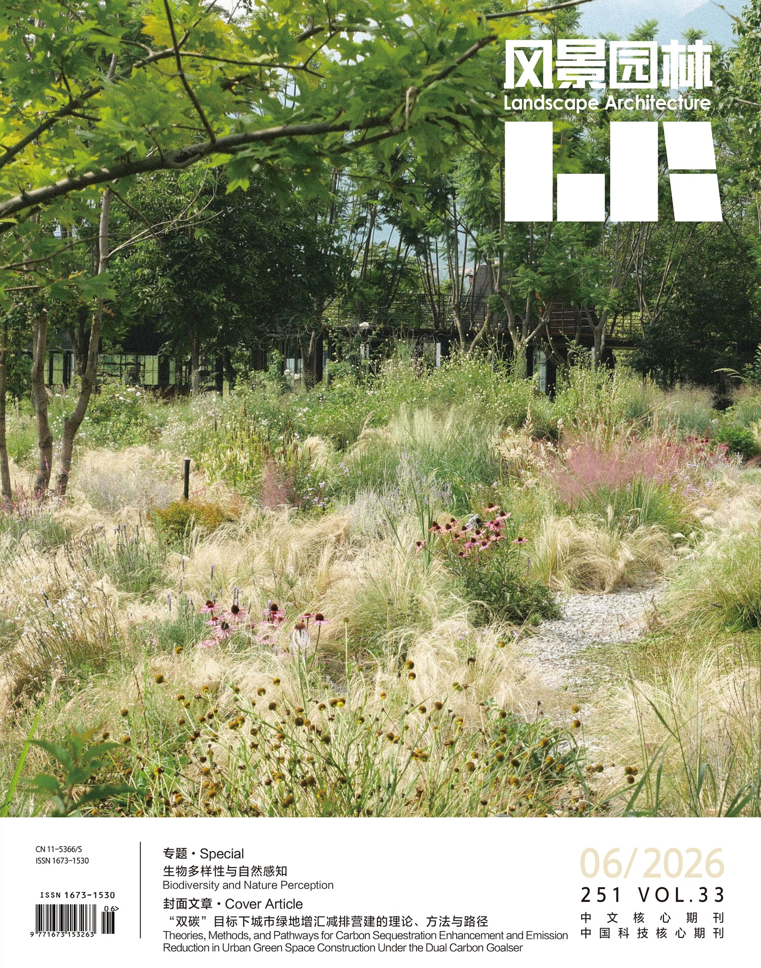
Under the context of the dual carbon goals and high-quality urban development, urban green spaces (UGS), as one of the most important natural carbon sinks in urban ecosystems, play a critical role in mitigating climate change and reducing urban carbon emissions. In recent years, research on UGS carbon sequestration has been evolving from single, static carbon stock assessments toward a comprehensive framework that integrates carbon budget, emission reduction effects, ecosystem service flows, and governance systems. This commentary discusses the theory, methods, and pathways of carbon sequestration enhancement and emission reduction in UGS development from multiple perspectives, including precise carbon accounting, life-cycle carbon budget, indirect emission reduction benefits, ecosystem service flows, and low-carbon planning and construction. The core viewpoints are summarized as follows: 1) Accurate carbon accounting is the foundation of UGS carbon sequestration research. Given the high heterogeneity of UGS, it is urgent to achieve a transformation from coarse estimation to dynamic and high-resolution accounting through multi-scale coordinated monitoring, integration of process-based and data-driven models, and the establishment of standardized methodological systems. 2) UGS are complex carbon metabolic systems under strong anthropogenic influence, simultaneously functioning as both carbon sources and sinks. Traditional accounting approaches focusing solely on biomass carbon sequestration tend to systematically overestimate their net carbon benefits. Therefore, localized parameter systems and standardized methodologies are necessary to dynamically characterize life-cycle carbon budget and better support the optimization of net carbon sequestration. 3) UGS provide significant indirect emission reduction benefits through multiple ecosystem services, such as mitigating urban heat island effects, improving air quality, and regulating urban stormwater processes. Future assessments should shift from single carbon sequestration evaluation to an integrated framework that combines direct carbon sequestration, life-cycle emissions, and multiple ecosystem services, thereby supporting high carbon-performance optimization of UGS. 4) Carbon sequestration and related ecosystem services of UGS exhibit strong spatial spillover effects, influencing urban carbon balance and spatial equity through ecosystem service flows. Planning at spatial scales should therefore focus on flow direction, flow magnitude, and transboundary ecological compensation mechanisms. 5) UGS are transitioning from traditional landscape spaces to low-carbon infrastructure systems. Carbon management should be integrated throughout the entire lifecycle of planning, design, construction, and maintenance, and a multi-scale, multi-process, and multi-stakeholder coordinated low-carbon green space planning and governance framework should be established.
The core objective of Building Information Modeling (BIM) development is interoperable information sharing. However, existing BIM data schemas are mainly oriented toward building assets and are not sufficiently adapted to the professional characteristics and engineering requirements of landscape architecture, especially in the representation of plant elements in China’s landscape engineering. To remedy the absence of a domain-ready data schema in the landscape field, this study takes plants—the core ecological elements of landscape systems—as its object, and develops an application framework from two tightly coupled dimensions: 1) the construction and platform internalization of a standardized plant dataset, and 2) the practical use of the Industry Foundation Classes (IFC) to achieve cross-platform, semantics-preserving exchange of plant objects in landscape engineering. Beyond addressing a modeling gap, the objective is to articulate clear, computable semantics for living vegetation that capture species identity, spatial morphology, ecological habit, and lifecycle management needs in ways existing building-focused schemas do not. The study aims to clarify the scope and granularity of plant information required for design coordination and long-term stewardship, reduce ambiguity in terminology and units across stakeholders, and establish a consistent basis for ecological asset representation within broader urban digital ecosystems toward digital twins and city information models.
Plant instances were first digitally defined through literature review, project investigation, and analysis of landscape engineering workflows. A standardized plant data checklist was established, consisting of 2 categories, 7 subcategories, and 25 core attribute fields. These fields cover identification, geometric dimensions, ecological habits, ecological functions, procurement information, construction information, and operation and maintenance information. The dataset was embedded into the Revit software platform so that field identifiers, value types and units, and value-domain constraints could be enforced at the point of modeling, enabling direct authoring and downstream validation. On this basis, a user-defined attribute mapping method was adopted to carry plant semantics in IFC without altering existing entity boundaries. The procedure comprised four steps: attribute curation, mapping-rule authoring, configuration-based export, and post-export verification. In practice, Revit parameters were aligned one-to-one with IFC properties and quantities via an external configuration file that records, for each field, the target IFC property name and value type (with units) together with its source parameter. This design ensures structural conversion of plant parameters into IFC while maintaining semantic fidelity across tools. Consistency checks were conducted before and after export to verify presence, type, unit correctness, value-domain validity, and equivalence between authoring and exchange layers.
The proposed method was applied to the Qianwan Park Phase I landscape project in Minhang District, Shanghai, with a project area of approximately 100,000 m2. The application enabled the extension and export of plant attributes from the native Revit model to IFC, while retaining the selected plant semantic information. With the standardized dataset internalized, the platform directly drove modeling and subsequent checking, and the exported IFC files provided structured storage of the 25 key plant attributes for representative plant species. In the viewer-based inspection workflow, attribute panels for representative species displayed identification information such as Chinese name, botanical name, family, and genus; geometric information such as height, crown spread, diameter at breast height (DBH), rootball depth, and rootball diameter; ecological information such as climate adaptability, soil requirements, and light requirements; and management information such as procurement items, planting date, and maintenance notes. Cross-species spot checks found no missing items, misplacements, or unit inconsistencies, as evidenced by semantic equivalence among the family parameter panels, the IFC property sets, and the viewer displays. Beyond technical fidelity, the normalized fields enabled immediate downstream use: species lists could be compiled programmatically; maintenance guidance could be filtered and scheduled from O&M attributes; and carbon-related estimates could use the geometric and ecological parameters as inputs with minimal manual preprocessing. The end-to-end validation artifacts further supported auditability and reproducible deliveries across design−construction−operations handoffs.
The findings enhance the digital expression of plant objects and strengthen the standardized, computable attributes of landscape ecological assets, thereby providing technical support for ecological, data-driven management of landscape projects. Concretely, the study demonstrates that a dictionary-led standardized dataset (2 classes, 7 subcategories, 25 fields) can be internalized in mainstream BIM authoring to unify semantics at source; and that a configuration-based IFC application method—maintaining current schema entities while conveying rich semantics through property/quantity groupings—can deliver cross-platform, traceable and verifiable plant information without modifying the IFC entity landscape. In a real-world park project with 35 tree species, the approach produced structured datasets that remained semantically equivalent across authoring, exchange, and viewing environments, and proved directly useful for species registers, construction communication, O&M planning, and carbon-awareness workflows. Strategically, this positions plants as first-class ecological assets within Landscape Information Modeling (LIM), enabling lossless information exchange across the lifecycle and facilitating integration with digital twins and city information modeling ecosystems. Future work will extend the dictionary and mapping pattern to additional landscape elements—terrain, pavements, water bodies, small structures, and site furnishings—under a unified, compatible data architecture; establish case repositories and sharing platforms to consolidate best practices; and explore generative algorithms to reduce manual authoring while better representing plant growth dynamics and seasonal change.
Rapid urbanization has profoundly reshaped land-use patterns and ecological processes in global mega-urban regions, posing major challenges to habitat sustainability and regional ecological security. As one of the most densely populated and intensively developed urban agglomerations in China, the Guangdong−Hong Kong−Macao Greater Bay Area (GBA) accommodates nearly 5% of the national population and generates over 12% of the gross domestic product (GDP) on less than 0.6% of the national land area. This highly compact development model has driven the continuous expansion of construction land at the expense of cropland, forest, grassland, and aquatic ecosystems, resulting in increasing habitat degradation and ecological pressure. Although previous studies have examined habitat quality or ecological patterns in the GBA, most have focused on static assessments or single-period analyses and rarely integrated historical evolution, future land-use simulation, and mechanisms of contribution within a unified analytical framework. Moreover, uncertainties remain regarding how different development pathways may shape future habitat quality trajectories. Against this background, this study aims to systematically investigate the spatiotemporal evolution of habitat quality in the GBA from 2000 to 2020, quantify the contribution of land-use transitions to habitat quality change, and explore the potential responses of habitat quality under multiple land-use scenarios through 2030. By coupling the patch-generating land use simulation (PLUS) model with the Integrated Valuation of Ecosystem Services and Tradeoffs (InVEST) habitat quality module, this research seeks to provide scientific evidence for regional ecological governance, spatial planning optimization, and sustainable development strategies in high-density urban agglomerations.
This study integrates land-use analysis, habitat quality assessment, and scenario-based simulation within a coupled PLUS−InVEST modeling framework. Multi-period land use/land cover data for 2000, 2010, and 2020 were obtained from the Chinese Land Use/Cover Change (CLUCC) dataset and reclassified into seven major land-use categories. Habitat quality was evaluated using the InVEST habitat quality module by incorporating habitat suitability, anthropogenic threat sources, threat intensity, and land-type sensitivity. Cropland, construction land, and unused land were identified as major threat sources to reflect human disturbance. Spatial patterns, temporal trends, and grade transitions of habitat quality were analyzed using GIS-based spatial analysis methods. Future land-use patterns for 2030 were simulated using the PLUS model, which applies a random forest algorithm to identify land expansion drivers and a multi-type random patch seed mechanism to generate spatially explicit land-use patches. Ten natural, socioeconomic, and accessibility-related driving factors were incorporated. Model performance was validated by simulating land use in 2020 based on 2010 data, achieving a Kappa coefficient of 0.897, indicating high simulation accuracy. Four future scenarios were designed: natural development (ND), agricultural development (AD), economic development (ED), and ecological protection (EP), reflecting different policy orientations. The contribution degree and habitat quality dynamic indices were employed to quantify the positive and negative effects of specific land-use transitions on habitat quality change under each scenario.
From 2000 to 2020, the average habitat quality in the Guangdong−Hong Kong−Macao Greater Bay Area declined from 0.431 to 0.395, indicating an overall degradation trend. However, the rate of degradation slowed significantly after 2010, suggesting that ecological conservation measures implemented in recent years have partially mitigated the habitat deterioration. Spatially, habitat quality exhibited significant heterogeneity, showing a distinct “periphery-high, core-low” pattern. High-quality habitats were primarily located in the northern and peripheral mountainous regions dominated by forests and grasslands, whereas low-quality habitats were concentrated in the highly urbanized core areas, including Guangzhou, Shenzhen, Foshan, and Dongguan. Land-use transition analysis revealed that the conversion of cropland and ecological land to construction land was the primary driver of habitat quality degradation. Approximately 75.76% of the study area remained stable in habitat quality grade, while degraded areas were mainly distributed in regions experiencing intense urban expansion. Scenario simulations indicated divergent future trajectories. Under the ND scenario, habitat quality showed slight improvement compared with that in 2020. The AD scenario moderately alleviated habitat degradation by reducing cropland loss and constraining construction land expansion. In contrast, the ED scenario significantly exacerbated habitat degradation, with extensive conversion of cropland and grassland to construction land leading to increased fragmentation. The EP scenario produced the most favorable outcomes, increasing mean habitat quality by approximately 1.8% relative to that under the ND scenario, primarily due to the expansion of forests, grasslands, and water bodies and strict control of construction land growth. Contribution analysis further confirmed that construction land expansion was the dominant negative factor, whereas ecological land restoration played a critical positive role in improving habitat quality.
This study demonstrates that land-use change plays a decisive role in shaping habitat quality dynamics in high-density urban agglomerations. By integrating PLUS and InVEST, the research provides a comprehensive framework linking land-use simulation, habitat quality assessment, and contribution-based mechanism analysis. The results indicate that while recent ecological policies have slowed habitat degradation in the GBA, future habitat quality trajectories remain highly sensitive to development pathways. Unregulated economic expansion may lead to persistent habitat deterioration, whereas ecological protection-oriented strategies can effectively enhance habitat quality even under continued urbanization pressure. These findings highlight the necessity of controlling construction land expansion, safeguarding cropland and blue−green spaces, and strengthening ecological restoration in core urban areas. The proposed framework and empirical insights offer transferable methodological references for other mega-urban regions, such as the Yangtze River Delta and the Beijing−Tianjin−Hebei urban agglomeration, and provide robust scientific support for regional ecological governance and spatial planning toward sustainable urban futures.
Nature education has been widely recognized as an effective approach to enhancing public ecological literacy and promoting sustainable development; however, most existing research and practice have primarily focused on children and often designed from the perspective of resource provision and park management, which may lead to a mismatch with visitors’ spontaneous recreational experiences. This study adopts an all-age perspective and utilizes user generated content (UGC) to construct an indicator system encompassing the content, objectives, and target groups of all-age nature-based recreational experience. Co-word analysis and an improved SnowNLP model were applied to assess public perceptions and sentiments of nature-based recreational experience in country parks. Specifically, the study aims to: 1) Examine the overall status of nature education and nature-based recreational experiences in country parks. 2) Assess the preference patterns and satisfaction levels of all-age groups for various nature-based recreational activities. 3) Compare park perceptions and evaluations across different population perspectives, explore underlying causes, and propose targeted optimization strategies to support the development of an all-age friendly urban nature education system.
This study focused on 29 country parks in Beijing, following a four-step research framework: 1) Social media data for 29 country parks were collected from the Dianping platform using Python and preprocessed. Based on Jieba word segmentation and following the Nature Education Guideline, three schemes were developed: one for indicative dimensions of nature education, one for nature-based recreational experience content, and one for objectives and target audiences. Dedicated lexicons were also constructed to support these schemes. 2) Based on a dictionary of target terms related to nature-based recreational experience, relevant review texts were extracted to identify the types of nature-based recreational experience content preferred by the public in each country park. Subsequently, the performance of three sentiment analysis models was evaluated, and the optimized SnowNLP model with the best overall performance was employed to quantitatively assess public satisfaction levels. 3) Comments related to different age groups were further extracted using the audience lexicon. Co-word analysis combined with sentiment analysis was employed to examine differences in preference patterns and satisfaction levels across age groups. 4) Cluster analysis was conducted to explore patterns of park groups based on all-age preference patterns and satisfaction levels, and park cluster maps were generated to reveal potential functional similarities and differences in nature education from an all-age perspective.
The results indicated that 1) Visitors frequently engage in diverse spontaneous nature-based recreational experiences, while explicit references to organized nature education activities remain relatively limited. 2) Comments related to nature-based recreational experiences across all country parks showed higher satisfaction scores than overall park comments, and the size classes and administrative levels of parks exhibited differentiated associations with visitors’ perception and evaluation characteristics. 3) The public demonstrated stronger preferences for experiential and life-oriented objectives, while expressing relatively low interest in abstract or knowledge-oriented topics. 4) Preferences for different nature-based recreational experience objectives varied significantly and exhibited clear group-specific patterns. 5) Overall satisfaction with nature-based recreational experience activities remained consistently high and relatively stable across all groups, with visitors traveling with friends reporting comparatively higher levels of satisfaction.
This study adopts a public-oriented perspective and utilizes UGC data to examine the characteristics of all-age nature education in Beijing’s country parks. The findings demonstrate significant differences in preference patterns and satisfaction levels for nature-based recreational experiences across age groups and companionship types. Based on these findings, the study proposes strategies such as enhancing public awareness of nature education, designing differentiated educational activities, and improving the overall environmental quality of parks, with the aim of fully leveraging their recreational and educational potential and strengthening their all-age educational functions. The methods and findings also provide empirical evidence and practical guidance for urban park managers and planners, offering a transferable framework for building age-inclusive urban nature education systems. This research offers targeted recommendations for optimizing the allocation of urban nature education resources and improving both public engagement and educational outcomes. Future research may refine this work by improving data acquisition processes and algorithmic models, thereby enabling a more nuanced understanding of the diverse nature education needs across different population groups.
The Three Parallel Rivers World Natural Heritage Site, as a critical area for biodiversity conservation and a significant representative of natural and cultural landscapes in China, has river corridors that not only serve as core links maintaining regional ecological integrity but also act as vital carriers for providing diverse recreational services. Owing to their unique hydrological dynamics, landscape stratification, spatial accessibility, and cultural profundity, river corridors constitute an irreplaceable component of human recreational systems. However, despite their notable recreational value, systematic research and scientific assessment of the recreational service functions of these river corridors remain relatively limited, with a lack of in-depth analysis regarding the spatial matching and coordination mechanisms between “resource potential” and “actual human use.” Therefore, establishing a scientific and rational evaluation system to comprehensively assess the recreational service functions of the river corridors in this region holds significant theoretical and practical importance for promoting sustainable management of recreational resources, enhancing the overall recreational quality of the heritage site, and fostering regional coordinated development.
To scientifically identify the spatial characteristics and coordination relationships of recreational service functions, this study constructs a dual-dimensional evaluation framework based on “Potential Capacity−Usage Level”. The potential capacity evaluation system encompasses two dimensions: recreational suitability (e.g., landscape richness, waterfront accessibility, cultural resource density) and ecological sensitivity (including vegetation coverage, slope stability, habitat fragility, etc.), aiming to objectively reflect the resource and environmental endowments supporting recreational activities in different segments. For usage level, user-generated trajectory data from the “Two Step” platform and population distribution data indicating usage intensity by local residents are integrated to quantify the actual utilization level of recreational functions from both tourist and resident perspectives. Analytically, the coupling coordination degree model is employed to evaluate the coordination level between the two dimensions; cluster and outlier analysis (Anselin Local Moran’s I) is applied to examine the spatial clustering patterns of the coupling coordination degree, while the relative development degree model is used to identify lagging and advanced types of regional development status.
1) Both recreational service potential and actual usage levels are significantly higher in riparian zones than in distant areas, demonstrating a distinct “near-river aggregation” pattern. Concurrently, significant longitudinal disparities exist between the upper and lower reaches of all three river corridors. Recreational usage is highly concentrated in the middle and lower reaches, which benefit from superior natural conditions and more developed infrastructure, whereas usage levels in the upstream regions remain consistently low due to terrain accessibility challenges and a lack of service facilities. 2) Tourist recreational usage for the Jinsha, Lancang, and Nujiang rivers peaks in autumn (September−November) and troughs in winter (January−March). The Jinsha River exhibits the smallest monthly fluctuations and the highest stability, attributable to the sustained appeal of core scenic spots such as Tiger Leaping Gorge. The usage patterns of the Lancang and Jinsha Rivers are highly synchronized, suggesting homogeneity in tourist source structures or influences from regional policies. In contrast, the Nujiang River displays an independent fluctuation rhythm, reflecting its more localized tourist sources or constraints imposed by local factors. 3) Approximately 90% of the study area is in a low coupling coordination state. Well-coordinated units are primarily distributed in riparian areas with gentle terrain and complete facilities, while low-coordination areas are mostly located away from the river channels. 4) Usage levels significantly lag behind the potential capacity in over half of the areas, and about one-third of the regions exhibit almost no recreational use—these “blank zones” are predominantly distributed along the steep canyon belts flanking the rivers. Spatially, the usage lag intensifies with increasing distance from the river channels. Longitudinally, all corridors exhibit a gradient differentiation pattern: “severe lag in the upper reaches−mild lag or basic synchronization in the middle and lower reaches.”
This study demonstrates that the dual-dimensional evaluation framework of “Capacity−Usage” can effectively reveal the spatial matching relationship and coordination status between recreational resource endowments and actual utilization, addressing the limitations of traditional unilateral assessments and providing a reliable pathway for refined evaluation and differentiated planning of recreational service functions. The research not only offers a scientific basis for recreational layout, ecological protection, and sustainable development of river corridors in the Three Parallel Rivers National Park and World Heritage site but also extends its methodological framework to functional assessments of other protected areas, green infrastructure, and ecological corridors, thereby supporting optimized allocation of recreational resources and high-quality regional coordinated development on a broader scale.