Project Articles

    Not found

    Default Latest Most Read
    Please wait a minute...
    For Selected: Toggle Thumbnails
    Research Progress of Black Soil in Northeast China
    Xiaozeng Han, Na Li
    SCIENTIA GEOGRAPHICA SINICA    2018, 38 (7): 1032-1041.   DOI: 10.13249/j.cnki.sgs.2018.07.004
    Abstract2616)   HTML50)    PDF (567KB)(947)      

    The black soil region in Northeast China is one of the world’s four black soil regions. It is well known for its high organic matter content and high fertility. It is not only the basis for the development of agriculture in Northeast China, but also the granary of China, which plays a decisive role in safeguarding the national food security. According to the characteristics and problems of black soil in Northeast China, this review first elucidates the forming conditions of the black soil and the natural characteristics. Secondly, we describe the evolution of soil properties and fertility in the process of the reclamation of black soil. The soil organic matter content and soil fertility decreased significantly, which have severely affected the sustainable development of agriculture in black soil region in Northeastern China. Besed on this analysis, different protection pathways and their controlling mechanisms on soil fertility are analyzed. Future research on black soil should be emphasized on the development of new technologies, new methods, and cross-disciplinary theories to ascertain the evolutional characteristics of soil fertility and their influencing factors. It is necessary to cultivate high-yield, high-quality crop varieties that are more suitable for the climatic conditions in Northeast China, to optimize the cropping system in combination with the current technological regulation pattern in this region, to improve the quality and yield of crops, to increase the overall productivity and competitiveness of agriculture soil, and finally to ensure the sustainable use of agriculture in the black soil region.

    Table and Figures | Reference | Related Articles | Metrics
    Cited: CSCD(11)
    Spatial Autocorrelation of Soil Moisture and Agricultural Zoning in a Mollisol Tillage Area of Northeast China
    GAO Feng-jie, SHAN Pei-ming, MA Quan-lai, HAN Wen-wen, ZHOU Jun, JU Tie-nan, WU Xiao
    JOURNAL OF NATURAL RESOURCES    2017, 32 (11): 1930-1941.   DOI: 10.11849/zrzyxb.20161062
    Abstract665)   HTML6)    PDF (5275KB)(357)      
    The paper mainly analyzed the spatial distribution pattern and spatial autocorrelation of surface soil moisture (0-20 cm) in a mollisol tillage area of Northeast China with the Moran index model of global and local spatial autocorrelation indicators. The paper discovered the spatial structure and distribution pattern of surface soil moisture and provided a basis for agricultural zoning and facility allocation. The results show that there is great spatial difference of surface soil moisture with moderate variation in the study area. The spatial variation is mostly caused by random factors such as human activities, tillage practice and so on. The global spatial autocorrelation coefficient is 0.417 7, showing strong positive autocorrelation, and there exists anisotropy of spatial autocorrelation. The local spatial autocorrelation coefficient is 0.374 4, mainly displaying H-H (high-high correlation) and L-L (low-low correlation) clusters, which shows the coexistence pattern of high value agglomeration and low value agglomeration. The H-H agglomerations mainly distribute in the flat area in the northwest of the study area. The H-H area has very good tillage condition and has priority in developing agriculture. When farming in this area, people can take full advantage of the nature to achieve high yield with low cost. The L-L agglomerations mainly distribute in the transition zone of mountain and plain in the east part of the study area where the surface soil moisture content is low. When farming in this area, people should invest more on agricultural irrigation infrastructure. In a word, this research could serve in allocation of regional water resources and agricultural facilities.
    Reference | Related Articles | Metrics
    Cited: CSCD(4)
    Effect Mechanism Research of Influential Factors of Cultivated Land Use System Security of Black Soil Region in Songnen High Plain:A Case Study of Bayan County in Heilongjiang Province
    SONG Ge, WANG Yue, LEI Guo-ping
    JOURNAL OF NATURAL RESOURCES    2014, 29 (1): 13-26.   DOI: 10.11849/zrzyxb.2014.01.002
    Abstract312)      PDF (5526KB)(55)      
    Cultivated land use system security is the foundation of protecting the health of cultivated land and guaranteeing food supply security. This paper takes Bayan County as an example, to determine the cultivated land use system security effect mechanism with single factors and composite factors, using Matlab programming, adopting Genetic Algorithm to improve Neural Networks, and recognizing the sensitive influential factors of cultivated land use system security by applying Path Analysis. There are two aspects we can conclude from the results. Firstly, analysis of single factors role to the cultivated land use system security indicated the strongest action intensity to system security is soil types, the weakest is altitude. Soil texture, soil types, geomorphological types, available phosphorus, policies and regulations and drainage ability have positive correlations with cultivated land use system security, and can promote system security, and the intensity of soil texture is 0.3133, soil types is 0.6830, geomorphological types is 0.3627, available phosphorus is 0.1189, policies and regulations is 0.2553, drainage ability is 0.1872. Altitude, difference vegetation index (DVI), and water and soil erosion have negative correlations with cultivated land use system security, and can restrain system security, and the intensity of altitude is 0.1046, DVI is 0.2028, water and soil erosion is 0.2877. The factors have different positive and negative correlations and play the roles of promotion and inhibition for the system security. Other influential factors of the cultivated land use system security play a significant part to the system. Secondly, the influential factors have complex constraints relations. The significant effect mechanisms are both single factors and composite factors with different dominant features to the system security. Soil types, geomorphological types and soil texture as natural ecological factors are significant in single mechanism to system security. Policies and regulations and drainage ability as humanistic factors are significant in composite mechanism to system security. Single mechanism as natural ecological factors plays significant part for system security. Composite mechanism as humanistic factors plays significant part for system security.
    Reference | Related Articles | Metrics
    Cited: CSCD(12)
    Planning and Design Modes of Land Consolidation in Typical Black Soil of Northeastern China
    JIN Quhuo, LIU Yuanqiu, WANG Jinman, WANG Ziwei, WU Kening, ZHAO Huafu
      
    Abstract182)      PDF (502KB)(37)      
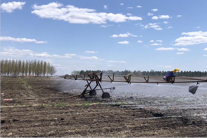
    Relying on fertile black soil resources, northeastern China has been developed as the biggest commodity grain base. Meanwhile, for hilly terrains, excessive use of concentrated rainfall and from other reasons, black soil is facing heavy soil erosion, fertility decline, and soil salinization, etc. Reasonably conducting and implementing land consolidation planning and design through ecological reconstruction, erosion control, and soil fertility are sound ways to cure those problems. Based on characteristics of natural resources and agricultural economic development trends in northeastern China, the authors discussed concepts, and planning and design technologies targeted for land consolidation in Lunhe Town, Hailun County, Heilongjiang Province. Guided by the philosophy of harmony between human and nature, the frame-oriented method and problem-oriented approach were jointly used to analyze the key problems and technologies needed for the land consolidation project in this area. Results of frame-oriented method analysis show that factors, like unreasonable land use spatial patterns, imperfect road systems, and fragmental ditches, are the major problems in the study area. Physical conditions, such as hilly terrains, concentrative rainfall, long-term extreme low temperature, and societal reasons such as mismanagement and deforestation, can not only lead to heavy soil degradation and serious damage of hydraulic constructions, ditches, and roads, but also result in low productivity and an imbalance among ecosystems. A series of engineering projects were proposed, such as land leveling projects, irrigation and drainage engineering, and road engineering residential renovation, etc. Meanwhile, other innovative methods of special land consolidation engineering design, such as easy disassembly, anti-freeze & anti-leakage back to plasma channel design, and anti-road-mudding road design, were suggested to reduce destruction of infrastructure due to alternating extreme low temperature and freeze-thaw climates in northeastern China. This paper can provide a basis for areas in cold regions where land consolidation planning strategies and design are needed.
    Reference | Related Articles | Metrics
    Cited: Baidu(6) CSCD(4)
    Analysis of Landuse Dynamic in Typical Blacksoil Region Based on GIS and RS—A Case Study of Hailun County
    XIE Ye-wei, LIU Zhao-Gang, ZHAO Jun, LI Yong, ZHANG Lei
    SCIENTIA GEOGRAPHICA SINICA    2010, 30 (3): 428-434.   DOI: 10.13249/j.cnki.sgs.2010.03.428
    Abstract529)      PDF (1145KB)(132)      
    Based on TM image data of Hailun during 1986-2007, supported by RS and GIS technology, the landuse change and landscape pattern characteristics were studied at Hailun County through the Markov conversion matrix, a single dynamic degree of landuse and landscape spatial pattern analysis, and the driving force of landuse change was analyzed. The results showed that:① The area of dry farming land and paddy field has been in a growth state, but growth rate slowed down, the fields are mainly from forest land, grassland and unused land.②Forest land, grassland and unused land area continued to decline; urban construction land and rural construction land area remained increasing with its rate growing quickly. ③Landscape pattern changes were mainly as follows: the degree of dominance increased integrally and the landscape diversity decreased, the mean proximate circular indexes of urban and rural construction land was the greatest. Woodland, patches fragmentation of unused land and waters increased.④ Humaous factors in population growth and economic development plays an important role in land-use change.
    Reference | Related Articles | Metrics
    Cited: CSCD(12)
    Applied productivity index model (PI) in soil productivity assessment of northern China
    SUN Zhen-ning, XIE Yun, DUAN Xing-wu
    JOURNAL OF NATURAL RESOURCES    2009, 24 (4): 708-717.   DOI: 10.11849/zrzyxb.2009.04.017
    Abstract400)      PDF (484KB)(99)      
    Related Articles | Metrics
    Cited: CSCD(7)
    The Effect of Soil Types on the Process of Farmland in Sanjiang Plain in Recent 50 Years
    BU Kun, WANG Wen-juan, ZHANG Shu-wen, ZHANG Yang-zhen, ZHANG Yu-bo
      
    Abstract153)      PDF (364KB)(18)      
    The soil map, DEM and land use maps of 5 periods derived from relief map, MSS and TM images are used to analysis the effect of the natural soil type to the process of farmland in Sanjiang Plain. The importance of different factors to the system made up of the soil type, terrain factors and process of farmland is analyzed based on the Rough Set Theory to indicate that the soil type influenced much more than the terrain factors. From 1954 to 2005, the land use/land cover changed greatly. The area of farmland increased 40 467.33 km 2, while the marsh wetland, forestland and grassland lost 22 831.30 km 2,13 691.34 km 2,6 143.52 km 2 correspondingly. The main nature soil types of Sanjiang Plain are dark brown soil, meadow soil, lessive, swampy soil and black soil, the sum of whom coved 88.53% of the area. The meadow soil, lessive, swampy soil and black soil are mainly distributed on the plain while the dark brown soil always appears on the mountain and hilly area. In the process of farmland expansion period from 1954 to 1986, the area of farmland increased from 13 173.70 km 2 to 45 112.78 km 2 with a faster speed than other periods. From 1954 to 1976, the new farmland was reclaimed on the fluvial terra of Songhuajiang River where is widely covered by meadow soil and swampy soil; from 1975 to 1986, the new farmland was reclaimed on the plain lied in the front of piedmont of the Wanda Mountain where is widely covered by lessive and swampy soil. After 1986, the new farmland emerged shows no obvious spatial distribution pattern. The ratio of the farmland area on one soil type to the area of that soil type reflects the reclamation intensity on different soil types. Up to the year of 2005, the reclamation intensity followed this turn: black soil>lessive>meadow soil>swampy soil>dark brown soil. Till 2005, 78.58% of the dark soil had been reclaimed for farmland because of the fertileness and vantage location, while only 20.89% of the dark brown soil was reclaimed because reclamation on such soil type is limited by the agriculture technology and protective policy. Then the ratio of the farmland area on each soil type to the whole area of the farmland is analyzed. Meadow soil is one of the main soil types of Sanjiang Plain., and the ratio of farmland area on it is great in every period because its fertility and convenience for agriculture. From 1954 to 2005, the ratio of farmland on the lessive soil and the swampy soil increased greatly from 15.97% and 2.35% to 24.64% and 13.72% separately, the ratio of farmland on the dark brown soil increased 6.12 percent as well, and the ratio of farmland area to the area of the black soil decreased from 15.97% to 10.72%. Reclamation on the other soil types made the ratio of farmland on the dark soil decreased because of its poor quantity. After the year of 2000, the reclamation on Sanjiang Plain gets to be stabile.
    Related Articles | Metrics
    Impact of Soil Type on Land Use/Cover Change in Sanjiang Plain
    JIN Cui, LI Fang, LIU Dian-wei, SONG Kai-shan, WANG Zong-ming, YANG Ting, ZHANG Bai, ZHANG Shu-qing
      
    Abstract166)      PDF (678KB)(23)      
    As an area recognized for grain production and abundant wetlands, the Sanjiang plain plays an important role in safeguarding national grain security and regional ecological security. Due to the impacts of intensive human activity, land use/cover in this region changed remarkably during the past five decades. This paper analyzes land use/cover change during 1954~2005 and explores the impact of soil type on land use and land cover change processes. During the past five decades, land use in the Sanjiang Plain changed substantially, with cropland area increasing by 2.25 times (385.56×10 4hm 2). Meanwhile, wetland, woodland and grassland area decreased by 256.72×10 4hm 2, 66.92×10 4hm 2 and 57.65×10 4hm 2. Meadow soil, bleached soil, marsh soil, dark brown soil and black soil were the soil types with the largest area of land use change. Agricultural reclamation and increasing cropland area are the main processes behind regional land use change. There was consistency between soil types where wetland, woodland and grassland decreased and soil types where cropland increased. The sequence of preferred soil type for cropland reclamation is: meadow soil, bleached soil, marsh soil and dark brown soil. Cropland reclamation began with meadow soils and bleached soils, which have relatively good natural conditions. As the availability of these soil types decreased, marsh soil became the soil type where most agricultural reclamation activities happened during 1986~1995 and 1995~2000. Later, dark brown soil was the soil type where most cropland reclamation activities occurred during 2000~2005, due to the reduced availability of land in the other preferred soil types.
    Related Articles | Metrics
    Cited: Baidu(4) CSCD(4)
    Effects of Land Use and Cover Change on Ecological Environment in Black Soil Region
    HAN Xiao-Zeng, WANG Shou-Yu, SONG Chun-Yu, QIAO Yun-Fa
    SCIENTIA GEOGRAPHICA SINICA    2005, 25 (2): 203-208.   DOI: 10.13249/j.cnki.sgs.2005.02.203
    Abstract694)      PDF (594KB)(190)      
    Black soils, located mainly in Heilongjiang and Jilin provinces of China, cover a broad area from 43皌o 48癗 and from 124皌o 127癊, with a total area of 5.93?10 6 ha.The black soils were cultivated about 200 years in south, 50 years in north and 100 years in central parts of the black soil area.These soils are one of the most fertile soils in China.These soils were cultivated for a relatively short time as compared to the soils in southern China.The vegetation changed from natural vegetation to crop-weed, to rotation of corn-soybean-wheat, or to rotation of corn-soybean.Steppified herbosa were flourished in black soil area under the proper weather condition for plant growth where the precipitation of about 500mm to 600mm mainly from April to September is synchronized with heat.The water status has changed dramatically with the use of land.If we take the water storage in the depth of 1m in spring in natural soil under the Steppified herbosa vegetation as control, the water storage under crops decreased to 20.4%, 20.6%, 22.6%, 27.2%, 29.3%, 27.3% after 2, 8, 15, 30, 50, and 100 years cultivation, respectively.The decrease of water storage was around 17.6% to 30.8% in summer investigation and about 19.7% to 29.9% in autumn measurement.According to the data from the three times measurement, we make a simulated calculation.The result showed that, the storage of water in this area was as high as a 24.9?10 9t reservoir in spring.The storage of water has decreased to 19.2?10 9 t after a hundred year cultivation.The impact of land use/cover on the soil water status is great.The capacity of land for storing water is decreased by 20% when cultivated for crops in contrast to natural soil.After the second year when the land was initially cultivated, the capacity decreased 6.9% every year with the cultivated time.So we concluded that the effect of soil use/cover is bigger than the time effect.The effect on black soil C pool of land use method and land cover is decisive, the C pool has a increase trend under original soil condition and steppified herbosa, it will decrease when black soil were reclaimed from its original state to farmland covered with crops.Compared with the capacity on soil C pool in 1 m soil layer under original soil condition and steppified herbosa, however, the organic C pool were decreased slowly by 23.71% on farmland after cultivation of 100 years.Plants need nitrogen as a macro-element.Method of land use and land cover affected the N pool in black soil in the same trend as for the C pool.Nevertheless the change in C pool in the layer from 50cm to 100cm is not significant in the period of 100 years;it is expected that much longer time is needed to have a significant change.It is land use/cover that makes tremendous influence on water and soil losses, but there is a litde relationship of water and soil losses with the cultivation time.Compared with the original soil and natural vegetation, the annual water loss of reclaimed farmland increased 27t/( ha·a);and there are as much as 50.93?10 6 t of water loss for the whole black soil area.Also the annual soil loss of reclaimed farmland increased about 38 t/ha;and there are 78.87?10 6 t soil loss for the whole black soil area.The over-cultivation not only resulted in the soil and water loss but also deteriorated the human living environment.
    Reference | Related Articles | Metrics
      
    Abstract294)      PDF (170KB)(58)      
    Related Articles | Metrics
    Cited: CSCD(22)
    AN ANALYSES ON LAND CONDITION OF THE HEILONG-JIANG PROVINCE AND HULUNBEIER LEAGUE ASRELATED TO ITS BUILDING INTO A COMMERCIALGRAIN-PRODUCING BASE
    Dai Xu Zhao, Songqiao
    Acta Geographica Sinica    1984, 39 (1): 65-74.   DOI: 10.11821/xb198401008
    Abstract1123)      PDF (653KB)(439)      
    Heilongjing province and Hulunbeier League, located at 42°34′N and with an area of about 710 000 sq. km, is the northern most province of China. Up to the end of ninteenthcentury, the region was called the "great northern wilderness". In less than 100 years, it has been rapidly turned into the "great northern granary". It has now 8.73 million hectares of cropland, occupying about one twelfth of the total cropland, and producing about one sixth of the total commercial grains in China. There are still about 7.41 million hectares o?arable virgin land which will enhance the development of this commercial grain base to an even higher level.The present paper consists chiefly of five parts.In the first part, natural conditions of the Heilongjiang province are briefly introduced. In general, the temperature, moisture and soil conditions are favorable for agriculture, although there are also some unfavorable natural conditions, such as low temperature, spring drought, summer flood, soil erosion and salinization in different areas and in varying intensities.In the second part, the history of agricultural reclamation is briefly reviewed. Three periods are dentified: (1) Up to 1897 A. D., there were about 5300 hectares of cropland. (2) From 1897 up to 1949 A. D., agricultural reclamation by small farmers developed very quickly. In about fifty years, the northern part of the Songhua-Nen Jiang plain and the whole Mudan Jiang valley were already well developed. In 1949, croplands of Heilongjiang province totalled about 5.7 million hectares. (3) After 1949 A. D., the agricultural reclamation by state farms and people’s commune has reached a new high level. The newly reclaimed areas have been mostly located in the Three River plain and in the piedmonts of the Great and Small Xing-an Ranges.In the third part, the present croplands are analyzed and assessed. Most of them are favorable for agriculture. But, as three-fourths of them are located at the gently, rolling slopes, soil erosion has been rather severe. According to an estimate, one half of the total cropland is subjected to erosion, and about one fourth of which is very severe. The land has been gradually degraded. Again, the producing capability of the cropland has not yet been fully developed, so far, yield per area is rather low.In the fourth part, arable virgin lands are evaluated. The total area is about 6.7 million hectares. According to their capability to be used productively, they may be classified into four categories. They may also be grouped into four land types: gentle slope, flat ground, meadow and marsh.In the last part, chief measures for increasing commercial grain production are introduced.
    Related Articles | Metrics
    BASIC FEATURES OF NATURAL ZONES IN THE NENJIANG AREA AND THEIR AGRICULTURAL DEVELOPMENT
    Shen Yuan-cun
    Acta Geographica Sinica    1982, 37 (3): 281-290.   DOI: 10.11821/xb198203007
    Abstract1090)      PDF (667KB)(630)      
    Nenjiang area is located in western Heilongjiong province. According to compre-hensive physical regionalization of China (1959). this area is wholly delimited tem-perate subhumid region and meadow steppe-black earth zone. Yet, according to our own field investigation in 1977-1978, two natural regions and three natural zone have been identified.Firstly, based upon temperature and moisture condition, the area may be divided into temperate sub-humid and temperate semi-arid natural regions, secondly based upon vegetation-soil criteria, temperate sub-humid region may be sub-divided into two natural zones: forest-steppe-black earth zone and meadow-steppe-chernozem, zone; and temperate semi-arid region contains only one natural zone-steppe-chestnut soil zone.In regard to agricultural development, forest-steppe-black earth zone should be devoted mainly to agriculture, secondly to forestry and thirdly to pasture; meadow-steppe-chernozem zone mainly to agriculture, secondly to pasture and thirdly to forestry; while steppe-chestnut soil zone mainly to pasture, partly to agriculture and forestry.
    Related Articles | Metrics
    Cited: Baidu(1)
    LAND TYPES AND THEIR DISTRIBUTION IN THE HEILONGJIANG PROVINCE AND HULUNBEIER LEAGUE
    Chao Sungchiao, Dai Xu, Shen yuancun, Yang Liulin
    GEOGRAPHICAL RESEARCH    1982, 1 (1): 49-57.   DOI: 10.11821/yj1982010008
    Abstract1373)      PDF (701KB)(1192)      
    In this article, taking the Heilongjiang province and Hulunbeier League as a example, some concepts on land study, such as land, land classlification as well as its rule of distribution are discussed.Land or terrain is a physical complex.It is an end product acted by whole physical factors, including climate, landform, hydrography, soil, vegetation etc. It includes also past and present human activities and their impacts upon environment.Based upon specific natural conditions of the Heilongjiang province and Hulunbe-cr League, principles for classifying land types are given. A hierarchical scheme for landclassification in the region are introduced. The first-level land unit is named "great land group" which approximates "land system" as called by Australian CSIRO. The second-level is named "land type", and the third-level, land association that only be studied and mappad in large-scale maps (usually larger than 1:50000).The Heilongjiang province and Hulunbeier League are located at 42°23'N throug-53°34'N, with a total area of about 710,000 sq km. It is situated mostly in the nor them part of the temperate zone. Its northernmost part and areas more than 800-1000m. above-sea-level belong to the cold-temperate zone. By taking landform, soil and vegetation as chief criteria for classification, 18 great land groups and 71 land types are identified.Horizontal and vertical distribution, as well as structure of land types are also discussed.
    Related Articles | Metrics