Population and urban studies
Appearance of Information and communication technology has set off a new wave of big data to promote a transformation of the traditional methods in urban studies. However, types of limitations of big data also make scholars rethink the role of small data in specific applications for research. We believe that the small data will not lose its value, instead, it can be combined with big data in urban study, which is needed to focus on relationship between urban and resident activity in the information era. Therefore, we should discuss a new framework for such combination on complicated urban problems and diversified resident demands. Firstly, we put forward to three methodologies including combination between physical space and activity space, combination between correlativity and causality, and combination between macro-scale analysis and micro-scale analysis. Secondly, based on above methodologies, we build three method frameworks for urban studies in the information era, namely ‘Spatial development evaluations for big samples+Spatial difference and connection discovery+Factors discussions for small samples’, ‘Model building for small samples+Factors discussions+Verifications and explorations for big samples’, and ‘Micro-analysis of activities+Delineations of activity space+Factors discussions’. Finally, we discuss applications of above three method frameworks.
The traditional economic growth theory considered that the main driving factors of economic growth were material elements such as labor, land, but lacked attention to the innovative elements like talent, technology and so on. While, In the era of the knowledge-based economy, the research on innovative city is booming and a series of theoretical achievement has been produced. Some conceptual systems, such as “National Innovation System”, “Regional Innovation System” had been put forward since the 1980s and deeply explored into the urban research during the subsequent studies, which brought a series of theoretical achievements related to innovative cities. Based on this, this article makes a literature review which focuses on the research of innovative city in recent years. Firstly, the article starts with the innovation theory proposed by Joseph Schumpeter, tracing back the theoretical source. Secondly, it makes a review on the main content of “Innovative City” involving the proposition and connotation, inscape and condition, developing type and pattern and so on, and on this basis, the theoretical evolution process of innovative city has been cleared up. That is the innovative city is an important part of the innovative country, and the city innovation system is a subsystem of the national innovation system. Therefore, the research on the innovative city is a further inheritance and development of national and regional innovation system theory in the level of city space. Then, the article makes introspection on the weak appoints of the present research on innovative city, in which the research on innovative city has fallen into as well as the lack of concern on the exogenous power source for city innovation. Aiming at the above problems, it can be clearly indicated that the further studies on innovative city cannot be limited to the construction of index system and the city rank according to their innovative performance. It should deeply step into the inner city based on those studies, and build an innovative system with a distinctive characteristic together with the most suitable constructional path and scheme by the dynamic analysis of some specific aspects of a city, which can bridge the “innovation” and “city”, such as the spatial environment, industrial structure, cultural connotation, development history and so on. Finally, the article points out the major breakout direction for the research and practice on innovative city in future as follows: the first is the individual road selection to setting up an innovative city, the second is that how to use the international innovative resource effectively to help building an innovative city. The above views not only exert a significant impact on the construction of innovative cities in developing countries and regions, but also is applicative in developed counties and regions.
Responses to the challenge of global warming include research into the adoption of low-carbon approaches to resource use. Accordingly, low-carbon-city studies refer to documenting, among other things, the relative significance of factors driving the current increase in urban carbon emissions. Such studies refer to the cycle and metabolism of the hypothetical low-carbon city, the low-carbon-city planning, and low-carbon-city environmental governance that would be needed in implementation. These low-carbon-city studies have deployed a range of methods, such as the LMDI method, Hybrid-EIO-LCA method, and CGE. The emphasis has been put on the study of low-carbon city in terms of sustainable development and its relationship with low-carbon economy and society, and on the establishment of urban ecosystems to form the symbiotic city and to realize smart growth and transit-oriented development of the low-carbon communities. Researchers from both economically developed and developing countries now notice that low-carbon-city research lacks attention to the comprehensive array of factors involved and that progress is limited by the interdisciplinary matters that must be dealt with, and the uncertainty attached to some of the available input data. Reconciliation of study results across a range of spatio-temporal scales is also a challenging issue. It is argued that it will be helpful to focus on the urban carbon energy-economy-society-environment system.
Sustainable city construction has become a fundamental guarantee for the sustainable development of human society. This paper systematically analyzed the sustainable city concept and its developing course, and presented an overview of the contemporary ideologies, trend of practices, methodologies,future discourses and key factors associated with sustainable city. It was required for the sustainable city construction to actively address the effectiveness of urban dimensions (form, structure and function), ecology, community and economic welfare sustainability. Meanwhile, building up the capacity of local government combining with political renovation, consciousness towards sustainable city and engagement of citizens had been identified as crucial factors for the successful implementation of local sustainability policies.
On the condition of globalization world, cities have uprised and global urban hierarchy has formed, and this is a remarkable phenomenon in current economic and urban development. Study on world city has been emphasized by both foreign and domestic researchers since 1980s. In this article the authors firstly divide the process of research on world city into three phases, including the early research phase (before the 1980s), the world city theory formation phase(in the 1980s, the main sign is the publication of Friedmann’s World City Hypothesis)and the world city theory development phase (from the 1990s to the present). Meantime, the authors also conclude the main present schools and trends of the world city research as follows: 1) Sassen’s global city hypothesis; (2) the Los Angeles school, including scholars such as Scott, Soja, Davis, Jameson et al; (3) the study on the information technology revolution and world city development by Castells, Batten,Warf, Hepworth, Lanvin et al; (4)the study on world city network mutual function by Taylor, Walker, Catalano, Hoyler et al; (5) the study on the world city of developing country and area. Then, the paper in detail introduces and explains the main ideas of overseas scholars research on world city’s concept, functions, classifications, formation mechanism, world city network mutual function et al. At last, the authors simply analyze Chinese scholars’ research process and present situation on world city and some thought of constructing world city in China.
Oasis cities are the typical region of arid zone, which have the densest human activities and the most sensitive relationship between human and environment. It is positively worth studying oasis cities of China for theoretical and practical reasons. The history of research on oasis cities in China is firstly looked back, which started in 1980s, boomed in the middle of 1990s and are deepening in recent years.The emphasized directions of research are different in three periods. Based on many study productions of oasis cities in China, four main representative focuses can be summarized: (1) Exploration of the spatial features of oasis cities. Relying on the background of arid land, oasis cities embody special characteristics in different space dimensions, which are macroscopic layout, urban system and microscopic landscapes, respectively. (2)Research on mechanism of oasis urbanization. Different factors, including landform, water and land resources, mineral resource, human requirements and economic developing levels, have different effects on the forming and developing of oasis cities. All of these factors are acting on development course of oasis cities all along, with different intensions in different stages. (3) Region response of environmental system to the development of oasis cities. Oasis urbanization has been manifested to give negative influences on the environment of some arid areas but to give positive ones in others. (4) Research on the restriction of water to oasis cities. Water resource is the key aspect of development in oasis cities, but is not an absolute barrier. Many ways to sustainable development of water resource in oasis cities are taken forward. The study of oasis cities is facing favorable opportunities in the near future. Three trends can help deepen the study, which are wider study field, crossing and amalgamation of multi-subjects, and synthesis of new methods and new techniques.
With the rapid development of regional integration, nowadays the regional inter-city migration gets the more attention of the scholars at home and abroad. Micro-blog, as one of the most popular application in China, has become a hotspot of research in areas such as sociology and computer. Check-in, as one of Micro-blog's functions, can reflect the flow of inter-city population in real time. We used the crawler program to collect the research samples in the Chengdu-Chongqing urban agglomeration in January 2014. The information includes the Micro-blog's unique ID number, the grid coordinates of Micro-blog sending place, and the city code of the registered place, etc. By running this program, a total of 804204 valid Micro-blog check-in data weare obtained from the Chengdu-Chongqing urban agglomeration. Based on Micro-blog checking areas, this study analyzeds the spatial structure of the Chengdu-Chongqing urban agglomeration. And Wwe combined the micro-blog data with the traditional socioeconomic data, in order to analyze the impact factors of the regional migration. The results indicates that the spatial structure of micro-blog shows the characteristics of "many centers of dual-core" group in this area. There are only two cities whose micro-blog flows are more than 100,000. They are Chengdu and Chongqing, forming athe “dual-core”. The direction of Micro-blog flow is affected by administrative division, and the intensity of Micro-blog flow presents a certain grade difference. The network shows an obvious hierarchy, and it closely correlatesnnects with the actual social-economic area closely, such as GDP, population size and the strength of traffic connection. For Chengdu and Chongqing, its GDP ranksed first and second,1, 2 respectively, with athe population size all of greater than 7.59 million and both as a regional transport hubs, it makes their micro-blogWeibo flows areintensity in ranked 1st and, 2nd, places respectively. Lastly, there are still some differences between Micro-blog's space and the actual geographic space inof Chengdu-Chongqing urban agglomeration. In the background of the national Yangtze River Economic Belt and China's new urbanization, we put the network information into the geographical space. Actually In this paper we discovered the spatial network characteristics of Chengdu-Chongqing urban agglomeration, and then this paper pointeds out the influence of socioeconomic factors on Micro-blog cyberspace flow. Of course, there may still be other factors behind Micro-blog's cyberspace, which need to be explored and analyzed in the future.
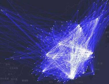
Simulations based on spatial interaction models have been widely applied to understand the strength of relationships between geographical elements, but many issues remain unclear and deviations between actual and simulated results have often been seriously underestimated. A high-precision Baidu migration process combined with mass relationships is applied in this study and enables the generation of regression coefficients of gravity model based on programmed large-scale regression simulations. A series of accuracy assessments are then developed for 2015 empirical projection daily regression coefficients that can be applied to Chinese spring interprovincial mobile gravity model variables as well as spatiotemporal research that utilizes regression coefficients within a heterogeneity research model. This approach also enables the error within the gravity model to be assessed in terms of floating population simulations. The results of this analysis lead to a number of clear conclusions, including the fact that parameter calibration complexity for the Chinese population mobility gravity model is reflected in the degree of influence asymmetry within spatial object interaction variables, and that the spatial heterogeneity of the variable regression coefficient increases in two distinct fashions. The first of these increases has to do with the overall influence of specific variables, including the fact that differences between proxies tend to be higher than inflow-outflow characteristics. In contrast, the second set of increases is related to economic levels, industrial scales, the proportion of the tertiary industry, and public service facilities. In this latter case, two-way population flow exerts a more profound influence on results and thus the scope of possible explanations for phenomena is more extensive. The regression coefficient for the existence of positive and negative proxy variables therefore relates to differences in spatial heterogeneity, including at the city level, and also assumes that floating population gravity model regression coefficients ignore spatiotemporal changes in the heterogeneity coefficient. This leads to spatial differences in estimated results and thus convergence trends, but further enables the identification of anisotropic interactions in extension space. The second main conclusion of this research is that the national scale population flow distance attenuation coefficient was 1.970 during the spring of 2015, while at the level of prefectural administrative units and given population outflow, the range encapsulated by this coefficient fell between 0.712 (Zhumadian) and 7.699 (Urumqi). Data also reveal a population inflow coefficient of 0.792 for this year that ranged as high as 8.223 in both Sanya and Urumqi. Population flow simulation results using the gravity model and including Baidu migration measured flow data were also subject to significant error. Third, the results of this analysis reveal a total fitting error of 85.54% in weighted absolute mean; the spatial interaction effect within this is responsible for a maximum error of 86.09% in actual and simulated flows, while relative outflow force and attractiveness encompass 57.73% and 49.34% of model error, respectively. These results show that the spatial interaction effect remains most difficult to model in terms of current factors.
According to previous studies, not only does the conditional gravity model based on ordinary least squares often bring about poor fitting of migration flows in reality, but also there exists overdispersion in the extended Poisson gravity model. Simultaneously, network autocorrelation usually exists in population migration data (e.g., the spatial interaction among migration flows). The problems mentioned above result in biased estimation. In order to capture network autocorrelation and deal with the issue of overdispersion, we build an eigenvector spatial filtering negative binomial gravity model (ESF NBGM) based on the data of 1% national population sample survey in 2015, to analyze the driving mechanism of interprovincial population migration flows in China. The results are as follows: (1) Positive spatial spillover effect exists in interprovincial population migration flows, and ESF can capture network autocorrelation in data, so as to reduce the estimated deviation of the model. Furthermore, eigenvectors ranking top 1.4% can properly interpret the spatial pattern of high network autocorrelation in data. (2) There exists overdispersion in China's interprovincial migration flows. Considering this problem, a negative binomial regression model is more suitable for the estimation of driving mechanism for population migration, together with statistical enhancement. (3) Network autocorrelation leads to overestimation of distance variables and underestimation of non-distance variables. The results of the improved model reveal that: chief factors the affect driving mechanism are regional population characters, social network, economic development and education level. Meanwhile, living environment and road network gradually become one of the most crucial pulling factors that influence migration flows. (4) Compared to previous studies, social network (i.e. migration stock) plays a more significant role in population migration flows, while the impact of spatial distance keeps weakening.
Under the background of human-oriented new-type urbanization, the citizenization of rural migrants attracted more and more attention from scholars and governments in recent years. On the basis of analyzing the China's urbanization and behavioral agencies, the paper indicated major difficulties facing the rural migrants in the process of social integration. The main findings are as follows: (1) the government, firm and individual are three main behavioral agencies in the process of urbanization in China, and their interaction is the main cause leading to the appearances of social exclusion. (2) The central government is mainly in charge of guiding the overall development of national urbanization by making top-level policies, while local governments play an important part in promoting local urbanization. However, by mean of the household registration system, local governments pay more attention to the economic development, and generally exclude the rural migrants from other administrative units to share the equal welfare together with the local residents. (3) Most China's firms mainly undertake labor-intensive industries, and most of them adopt low-wage and low-social security policies to decrease the productive cost. These measures result in low wages and low social security level for rural migrants and hinder their social integration. (4) The human capital characteristics of individuals also have an important influence on the social integration of floating population. Generally, the rural migrants with more human capitals (well-educated, younger, etc.) are more likely to integrate themselves into local society. Among the three behavioral agencies, the rural migrants are no doubt in the weakest status, and the institutional obstacles hinder them to embed in the urban society. In the end, some suggestions were proposed to promote the social integration of rural migrants. Firstly, we should deepen the reform of the household registration system, build an inclusive city, and promote the equalization of basic public services. Secondly, the government, firms and individuals should share the cost to realize citizenship.
The unequal urban-rural relation in the pre-reform period has been shifted into urban areas in the form of unequal intra-urban relation between residents with local hukou and floating population without local hukou. Thus current urbanization of China is incomplete and not inclusive. To achieve complete urbanization in China, attention should be paid to three important aspects: the usual rural to urban migration, the integration or inclusion of floating population in urban areas, and the urban-rural integration in the urban periphery. The government and enterprises are partly responsible for the problems facing the temporary population. The paper discusses the basic theories of urbanization in the context of hukou system as well as the theories of urban integration of floating population. The author argues that the system approach should be used to study the urbanization and urban-rural integration issues. The approach can be applied to the planning, development, construction and expansion of people-nature symbio-tic systems at various scales. A new town example from Hong Kong is used to demonstrate what kind of sustainable communities may be planned and developed to meet the aspiration of residents in modern cities.
In this paper, the urbanization of China's population was subdivided into "townization" and "cityization", and the indicators of "townization level" and "townization contribution rate" were adopted. From the perspective of different spatial scales and major function oriented zones, this paper conducted the system analysis on space-time disparity and influencing factors of the development of urban population in China from 1982 to 2015. The main conclusions included: (1) China's urban population's "townization level" and "townization contribution rate" continued to increase. In 2015, townization level was 41.8%, and the townization contribution rate was 55.1% during the period from 2010 to 2015. (2) The urbanization of China's urban population presented significant spatial and temporal differences. The townization-dominated counties and cities were mainly distributed in the central and western regions of China, accounting for more than 70% of the country's total land area. The cityization-dominated counties and cities were mainly concentrated in coastal urban agglomerations, and had a relatively small proportion in the national land area. (3) Looking into the future, China's urban population's "townization level" and "townization contribution rate" would increase steadily but slower and slower. It was necessary to strengthen the exploration of a differentiated development model of small towns based on the differentiation of major function oriented zones.
The space pattern of urban population distribution is a classical research topic of urban science and urban planning. In terms of the current research situation of urban population distribution, the LBS big data technology which is considered as a new method and tool to observe the urban spatial and temporal characteristics is introduced into the research of urban population distribution based on the traditional space syntax model. Then, a new idea of urban population distribution research with the integration of theoretical distribution and actual distribution is established. The case study in the central urban area of Hefei City shows that: the spatial clustering areas obtained respectively by space syntax model and LBS big data analyses are different in space. According to the comprehensive comparison of space syntax model and LBS big data analysis, the central urban area of Hefei City is divided into 3 types of population distribution including high density, medium density and low density. The high density zoning consists of the old town, Shushan district and Baohe district. The medium density zoning includes Binhu district, Luyang district and High-tech area. Meanwhile, the low density zoning consists of economic developing area and Yaohai district. Finally, the suggestions of population distribution development in different density partitions are proposed. The research shows that the timely and dynamic characteristics of LBS big data can make up for the shortcomings of traditional data and greatly broaden the source and timeliness of basic data. Obviously, this will enhance the accuracy of the study. And, more importantly, it will provide more accurate and efficient tools and methods combined with the classical space syntax model for the study of urban population distribution. In addition, it is hoped that this research can make some exploration and reference for expanding the practical application field of LBS big data.
After the financial crisis in 2008, a new phenomenon “shrinkage” has appeared in Dongguan’s urban area, which manifested population size reducing in its towns. Although the economic recovery rapidly in the post-crisis period, the spatial separation of population growth and shrinkage is aggravating, accompanied by a series of changes in the demographic structure. Base on the perspective of demographic change, this article makes an in-depth analysis of the growth and shrinkage in Dongguan by using the Social Security Registration data. We summarize the characteristic of demographic changes in the size, age, gender and education after the financial crisis, and industrial economic structure of different towns. Moreover, we construct a panel regression model for exploring the factors and mechanisms that affect urban population growth and shrinkage. The result shows: 1) While the population size of Dongguan tends to growing in fluctuation, the population structure shows trends for migrant population localization, male and female more imbalance, younger and highly educated population. 2) Advanced manufacturing and modern service industries to promote city growing, and outward processing and manufacturing transformation failure will affect the city shrinking. 3) The spatial distribution shows the "growing in the north, shrinking in the south", forming a concentrated area where the central area growing, the northwest area and the southeastern area are shrinking. 4) Macroeconomic fluctuation, industrial transformation, technological innovation inputs and local development pathway have significant impacts on demographic growth and shrinkage in Dongguan.
Urban population data are the basic data in various social and economy fields, and high-resolution spatialized urban population data are of great importance for the research in such fields. In this article, multi-source remote sensing data were used to extract the urban impervious surface changes in the Guangdong-Hong Kong-Macao (GHM) Greater Bay Area at a spatial resolution of 30 meters from 2007 to 2015. The Dasymetric mapping method was used to spatialize the population at different times to a resolution of 30 meters. We finally estimated the gridded population density distribution of 30 meters resolution, and analyzed the spatiotemporal changes of the urban population in the GHM Greater Bay Area from 2007 to 2015. Validated with Google Earth time series high-resolution images, the accuracy of the derived urban impervious surfaces in GHM is generally above 80%. Using the county-level demographic data, the consistency between the estimated population and the statistical data in the GHM Greater Bay Area was analyzed, and the correlation coefficient (R2) was generally above 0.7. Finally, according to the spatial distribution of urban population and the change of population density, urban expansion and population increase patterns of different cities in the GHM Greater Bay Area were analyzed. The research shows that the urban population of the GHM has special spatiotemporal characteristics: (1) Stable population distribution is observed for Hong Kong and Macao, but other urban areas have experienced expansion of population to different extents and in different directions. The population expansion of Guangzhou, Shenzhen, and Dongguan is most obvious. (2) The spatial distribution of urban population in GHM shows multi-scale and multi-center characteristics. In general, the population of GHM is concentrated in the core area centered at the Pearl River Estuary. The Zhaoqing, Jiangmen, and Huizhou areas are sparsely populated. In the core area, the distribution of urban population shows the characteristics of multi-center distribution on both urban and metropolitan scales. Hong Kong and Guangzhou have multiple urban centers, while Hong Kong, Macao, Shenzhen, and Guangzhou are the centers of the GHM. These four centers can drive the overall development of the GHM Greater Bay Area.
The Guangdong-Hong Kong-Macao Greater Bay Area with economic geographical advantages is deemed to be the growth point that captivated the world for its impetus to the global economy. This article focuses on the nine main cities of the Pearl River Delta, analyzing the mutual influences among industry-population-space during the rapid development process of this urban agglomeration by constructing a vector auto regressive model and impulse response function and variance decomposition analysis. The results show that: The absorption effect for population in the development of industry in the urban agglomeration of the Pearl River Delta faded in the late stage. The acceleration that industry benefitted from population aggregation weakened in the middle and late periods. The spatial expansion effects on population aggregation were limited and have become negative in the late period. It concludes that in general a short-term mutual promoting development mechanism between industry-population-space was formed, but a long-term mechanism is yet to be developed. In order to promote the development of the Greater Bay Area of Guangdong-Hong Kong-Macao, the urban agglomeration of the Pearl River Delta should attract highly-qualified workforce on the basis of industrial upgrading, plan spatial growth according to the population aggregation, and construct a multilevel synergistic industrial space with complementary products and services. With these measures, the overall aims are to strengthen the synergistic development among industry, population, and space and promote the development of the Greater Bay Area of Guangdong-Hong Kong-Macao.
A large floating population has entered urban areas under the rapid urbanization in China. However, their residential space pattern is strongly affected by residential self-selection, which has reconstructed the urban population distribution pattern and social space. This study examines urban floating population residential space pattern and its formation process, by using the floating population data of 2010 and 2015 in the yearbooks of Chengdu downtown block, and choosing influence variables from the perspective of behavioral decision made by the urban floating population. Therefore, the aims of this study are to analyze the influence of urban characteristic variables for residential self-selection and the influences' spatial differentiation, and to reveal process of space trade-offs in residential self-selection and its role in the formation of urban floating population residential space pattern. The results show that from 2010 to 2015, the urban floating population of Chengdu increased rapidly in the southern part of the downtown area and in the urban centers, and a significant space agglomeration situation featured by low-west and high-east is obviously reflected. Moreover, residential space pattern of urban floating population shows that the level of residential segregation is partially related to the residential space pattern of the registered population, but a notable degree of residential segregation has reduced from 2010 to 2015. More importantly, the study proves that the proportion of urban floating population in permanent residential population, residential land area, housing rent, public transportation, enterprise, hospital, drugstore, restaurant and marketplace have influences on floating population residential self-selection. In addition, the proportion of urban floating population in permanent residential population, residential land area and housing rent are the three significant variables in the spatial error model, but it is dramatically impacted by spatial autocorrelation of floating population statistic block. A major contribution of this study is that the spatial differentiation of the variables' influence on residential self-selection is verified by using geographic weighting regression (GWR), and it reveals the process of urban floating population space trade-offs on how to realize residential self-selection by weighting spatial variability of variables’ influence among different urban regions. That is to say, the spatial difference of living cost, employment opportunities, living environment and commuting costs have shaped the floating population residential space pattern, which is a complex reflection of the urban spatial perception, spatial trade-offs and spatial self-selection of floating population. It can help us to deeply understand the formation process of urban floating population residential space pattern, and provide references to promote community integration and urban management.
Residential segregation has been a severe and widespread phenomenon in mega cities along with fast urbanization in China. Migrants from rural area flock into developed cities especially coastal regions for better job opportunities, which provide essential cheap labor for urban growth. However, their housing problems could not be resolved in formal housing either hindered by institutional barrier or unreachable housing price. The housing segregation gradually formed as locals reside in formal gated communities while migrants crowd in informal housing like urban villages, which is characterized with lower rent but substandard living conditions. The housing segregation in China derives from household registration system (hukou). The Index of Dissimilarity (ID) only emphasizes the unevenness of population distribution but could not fully manifest the segregation characteristics in density, location, proximity, etc. Inspired by the work of Massey Denton in multi-dimensional segregation, this article applies three measures of housing segregation (Clustering, Centralization, and Concentration) based on the ID to analyze the segregation between urban residents with and without hukou. It examines the multi-dimensional housing segregation based on hukou status using data from China’s 6th national census in 2010. The typical migrant city Shenzhen was chosen to conduct the case study, and the segregation index of three dimensions was calculated based on 55 sub-districts for comparison. The multi-dimensional segregation indexes showed that Shenzhen has high segregation problems at the city scale, but more homogeneous inside each district. The history, industrial structure and socioeconomic background of each district play a crucial role in the segregation. The outside-custom area provides more chances in labor-dense sectors and attracts more migrants to reside in a large scale, while the inside-custom regions are more advanced in informatics and financial sectors, which results in scattered spots of migrants housing. Cluster analysis reveals the three types of segregation, each of which has its unique processual mechanisms, and policy prescriptions. The study shows that the housing segregation has multiple dimensions and scales. Thus two sets of people could be featured by a single ID yet to be clustered or dispersed, central or peripheral, or concentrated or deconcentrated. Migrants may occupy continuous neighboring blocks in peripheral area, or densely reside in few scattered urban villages in inner city, or congregate in factory dorms alongside each industrial zone. Based on segregation patterns, locations and density, local governments should take different measures like redevelopment of targeted urban villages, large-scale public housing construction or cooperation with factories in worker dormitory improvement accordingly. This article contributes an innovative and comprehensive perspective to conceptualize housing segregation, and provides policy recommendations to deal with the social problems that arise from segregation in China. With the advancement of big data, more practical real-time housing management measures could be developed for practitioners to provide human-centric housing planning and avoid the housing polarization.
Economic development zones play an important role in urban and regional development. They have become a magnet for capital and migrant flows, which stimulate various production relations, and gradually turn into new social space, with important significance to inclusive urban and regional development. Previous efforts of special economic zones, however, place great emphasis on economic development, with few considerations of social development. Although this problem has attracted much attention, there is lack of a systematic view of livelihood of migrants, which results in incomplete understanding and policy approaches to improve social inclusive development of economic development zones. With an empirical study on Nansha New District in Guangzhou, this paper attempts to establish a multidimensional analytical framework of livelihood space to facilitate an understanding of livelihood capital of migrants. The result shows that the livelihood space of migrants in the economic development zone has both expansion and compression compared to their hometowns or other areas. Migrants in Nansha have dramatically improved their livelihood. But compared to the locals, their livelihood capital is still lower. Overall, their economic space has been extended, while the policy space, public service space and residential space are compressed. The compression and extension of the livelihood space of migrants has the relationship of mutual restraint or promotion, which together constructs the unique livelihood space of migrants. The household registration system is an important influencing factor. In addition, the willingness of migrants to stay in the development zone has complex formation mechanism and livelihood capital shows little impact. Therefore, a better livelihood space of the migrants in the development zone is of great significance to improve the living conditions of industrial workers in the city and shape the development strategy of inclusive urban development. These findings can contribute to Lefebvre's theory of space production, pointing out that there is a continual process from production to social space and the latter is increasingly important.
Urbanization is an inevitable trend of modernization and the fundamental transition in socioeconomic structure, human production and life style. China is undergoing a rapid and unprecedented urbanization process, and has achieved the short-term goals that European and American countries attained in the past decades or even centuries ago. This kind of rapid expansion has inevitably led to a serious imbalance between urban land expansion and urban population growth. We used the demographic-landscape urbanization coupling relationship index (ratio of the annual average growth rate of demographic permanent population and urban development land) to explore the spatio-temporal characteristics of demographic-landscape urbanization coupling situation, and further explain its driving forces during the past decade in China. All analyses, based on the demographic statistics and landscape dataset of 636 cities in China, aimed to identify and diagnose six coupling types. Furthermore, we made the macro pattern of urbanization development level more visible with the help of Kernel Density spatial analysis tool. Results show that: (1) Over the past decade, the average annual growth rate of urban development land in China was 1.65 times that of the urban population, and demographic-landscape urbanization coupling situation was poorly coordinated. (2) We found that there is a spatial dependency between demographic urbanization and landscape urbanization. Moreover, the spatial agglomeration center of high-density urban population showed a gradual westward moving trend. Meanwhile, urbanization development mode shifted from "land lag" to "population lag". (3) Generally, the area of per capita urban development land has exceeded the standard threshold; and 41.96% of the cities currently have a development land area per capita more than five times of the ideal value. (4) The proportion of three coordination types was 73.25%, which is much higher than that of three incoordination types (26.75%). Among them, "Both Growth and Uncoordinated Type" took the largest proportion of 43.27%, which reflects the uncoordinated relationship between demographic urbanization and landscape urbanization. This situation will continue or even is intensified in the years to come. Additionally, the cities located at the edge of urban agglomeration seemed to be more uncoordinated than cities at the center. This is probably because that the cities at the edge of urban agglomeration, which had a small population and low property price, relied more on the "land finance" to earn their main source of urban economic income. (5) Economic development level, population size, governmental decision-making behaviors, geographical location and regional disparity were all driving factors of demographic-landscape urbanization. In addition, there are few obvious differences in the mechanism and effect of these factors. To sum up, urban population and land use management in the new era should get more attention according to the new trend in system diagnosis and comprehensive analysis, thus to provide a scientific basis in development decision for new urbanization and urban-rural integration strategy as well as the rural revitalization strategy.
Based on multiple types of data and using qualitative and quantitative analysis, the paper analyzes the spatial-temporal characteristics and influencing factors of population changes in Beijing-Tianjin-Hebei (BTH) region from the two aspects of population distribution patterns and population floating in long and short periods. The main results are summed up as follows: (1) BTH region presents an obvious population distribution characteristic, which is influenced by physiographical conditions and traffic location factors; Beijing-Tianjin region reflects the prominent circle features, which is due to social and economic development; and Hebei lacks a mature regional sub-center. From 2000 to 2010, the population of this region is characterized by a significant growth. (2) Over a long period of time, the vitality of population floating has increased and the pattern of population floating is more concentrated. Over a short period of time, Beijing and Tianjin have become the hottest cities of population inflow and outflow respectively in China. The population floating among Beijing, Tianjin and Langfang is the most active, while the Beijing-centered population floating is relatively active. (3) The main influencing factors of the spatial-temporal change of population over a long period of time include human capital accumulation, industrial structure, urbanization, initial economic development level, rurality and public services, geographical location, central city radiation and topographic relief. Holidays and seasons are the important superimposed factors that affect the direction and quantity of short-term population movements.
Based on the national census data of 2000 and 2010 as well as population sample survey of 2005 and 2015, this article utilizes the interaction value to analyze the dynamics of floating population in China. The analysis of "population floating system" demonstrates that: (1) Floating population shows great aggregation, in which exist several "population floating systems". (2) The development of the Yangtze River Delta and the Bohai Economic Rim has witnessed the northward trend of the floating population. (3) The improving inter-provincial connections among the western region has gradually strengthened its importance in China since 2010. In addition, the unidirectional interaction value can not only indicate the scale of the population flows but also explain their directions: (1) The largest unidirectional interaction flow occurs mainly between provinces in eastern China and those in central or western China which are exporters of labor forces. Even though eastern China gathered most of the floating population, some provinces have gradually lost their dominance in attracting population from central and western China. (2) The floating population in China presents a "asymmetric bilateral pattern". With the decline of the three major population centers, return flows have become remarkable. (3) Some sub-centers of floating population emerged in the central and western regions, though they are still developing. (4) Population nearby floating has become increasingly prominent in the western region. According to the analysis above, population research can benefit from the interaction value model by considering the inter-provincial population flows among the whole system and presenting their directions. Meanwhile, making comparison of population flows between 2010-2015 for a better understanding of the new characteristics and patterns of floating population is meaningful in formulating population policies and promote regional coordination.
While population maps are important tools for people to perceive the regularities of population distribution, different scales of population maps cause map readers' cognitive difference in the regularities of spatial distribution of population. In this paper, eye movement parameters such as number of fixations, fixation duration and number of correct answers were selected in the population map cognitive experiment by eye movement tracking to test the significance of the difference, and the results were analyzed from the perspective of spatial differentiation regularities. By exploring the influence of different scales including province and county (city) on map readers' cognition of the distribution regularities of population, it is concluded that different scales of population maps have a significant impact on readers' perception based on the significant difference analysis. When perceiving the characteristics of spatial distribution of population and the population quantity, more details and information are provided by county (city)-scale population maps, which is beneficial to readers' understanding of the spatial differentiation regularities of population, with less average number of fixations, shorter average fixation duration, more correct number of answers for each question and higher cognitive efficiency. The impact of scale on the cognition of the population spatial distribution and the population size was discussed. The acquired cognitive rules of the scale can be used in designing the demographic maps and shortening readers' cognition time, which is convenient for readers to extract valid information from the demographic maps, thus to improve the map usability. Besides, through the analysis of eye movement parameters like the fixations points, fixation time and number of correct answers, as well as the significance test, quantitative researches of the scale effects on the population distribution were carried out. The perspective drawing of the fixations hotspot can be used to visualize the cognitive spatial differentiation of the readers. And the results are no longer limited to the simple qualitative expression, which is of great significance for the use of different scales of demographic maps to express population distribution characteristics and regularities. In addition to adopting the hierarchical mapping method to draw the population maps, this thesis also has conducted experiments on the readers' cognition of the spatial distribution regularities of population with different population density maps at different scales. Since it can reflect the population distribution more precisely and more visually, the results of this research may be further improved. And in the further work, the above population map needs further studying.
Urban population distribution and activities are always the hot research topics. Identifying the spatial-temporal variation and predicting future trends are of great significance for estimating population accurately, making policy effectively, and warning of population booming timely. With the availability of data and the development of data processing technique, multisource data with both spatial and temporal features, such as mobile signaling data, have been used in population studies. In this paper, q-statistic was firstly applied as an exploratory analysis, then Bayesian spatial-temporal models were used to evaluate patterns of urban population and make prediction of future trends. The Chaoyang, Beijing in 2017 was selected as empirical study of this model. The spatially stratified heterogeneity was detected by q-statistic in Geodetector firstly. Then we explored the overall spatial variation, overall time trend and the departures of the local trends from the overall trend of resident population in Chaoyang by use of Bayesian spatial-temporal hierarchical model. Secondly, we applied Bayesian Gaussian predictive process to predict the resident population in December of 2017 by incorporating other relevant influential factors. The results show the perfect spatial stratified heterogeneity for resident population in Chaoyang, and the overall spatial variation demonstrates an increasing trend of population from center to the outside along the main ring road in Beijing. The overall time trend is still growing all over Chaoyang district, while the local trends, which departure from the overall trend of resident population, are different between each sub-districts in Chaoyang. Moreover, the spatial distribution of predicted resident population shows a high consistency with the observed resident population, and the prediction accuracy can be well accepted on the scale of Chaoyang district. However, prediction accuracy shows obvious difference on scale of sub-districts, with the worst prediction accuracy in the capital airport area. These findings show that Bayesian hierarchical model and Bayesian Gaussian predictive process are reliable in empirical study of population evaluation and prediction by effective application of multisource spatial-temporal data. Researches in this paper can be an excellent theoretical and practical support for mining multisource spatial-temporal data and assisting multiscale analysis with Bayesian spatial-temporal model, and provide an important basis for population controlling and early warning in urban population management.