
浙江省宁波地区地质灾害隐患点遥感综合监测识别
|
高峰(1971-),男,高级工程师,主要从事城市工程测量、城市地质安全、地质灾害、地面沉降、地下水、地下三维模型以及相关工作的信息化研究。Email: gf_ep398@126.com。 |
Copy editor: 李瑜
收稿日期: 2024-07-15
修回日期: 2025-02-25
网络出版日期: 2026-06-03
Monitoring and identification of potential geological hazard sites using comprehensive remote sensing in Ningbo, Zhejiang Province
Received date: 2024-07-15
Revised date: 2025-02-25
Online published: 2026-06-03
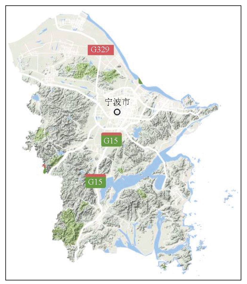
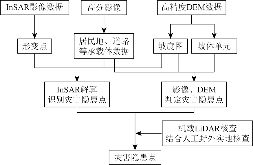
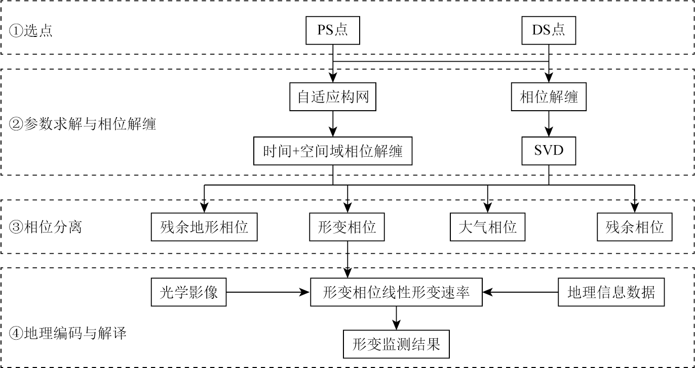
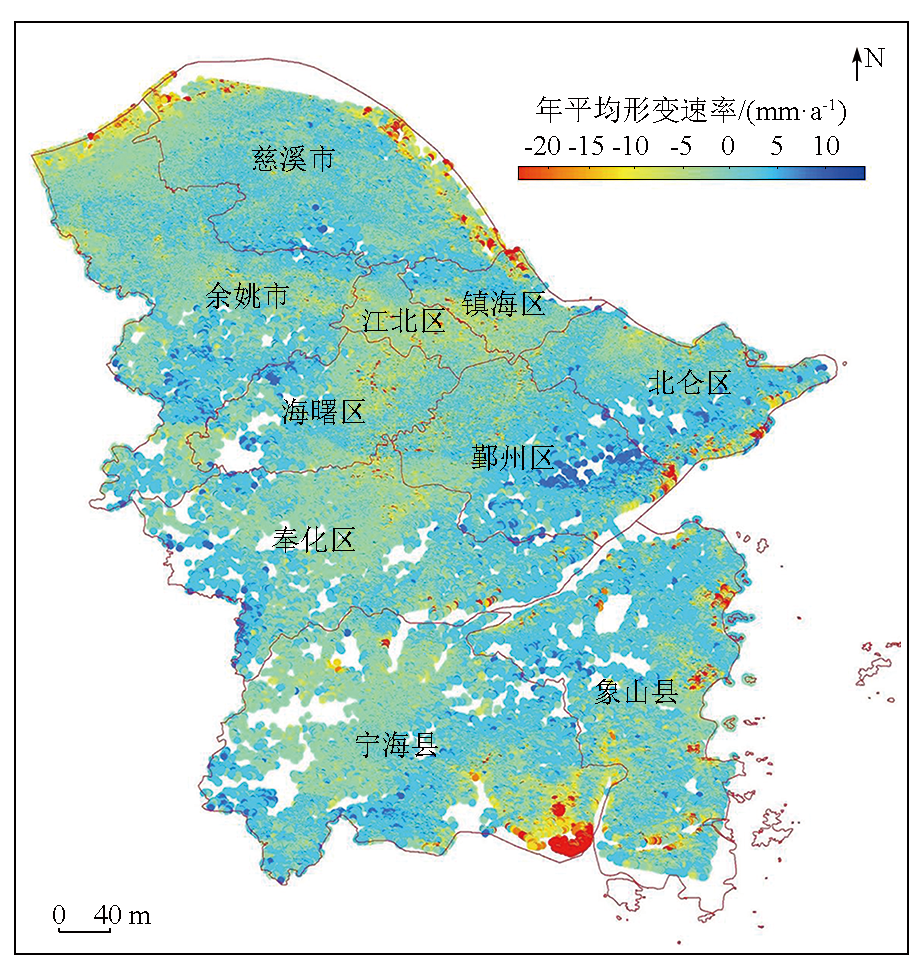
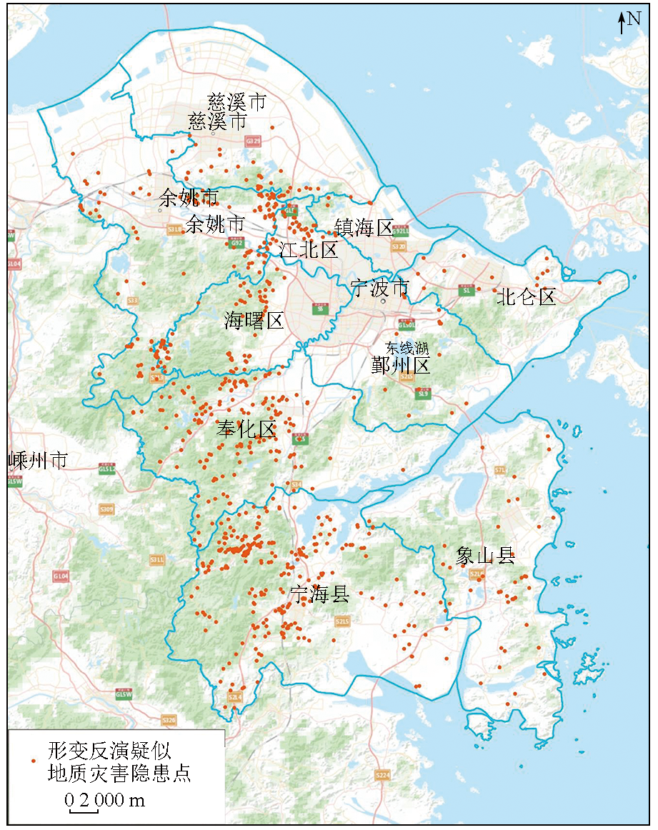
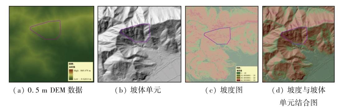
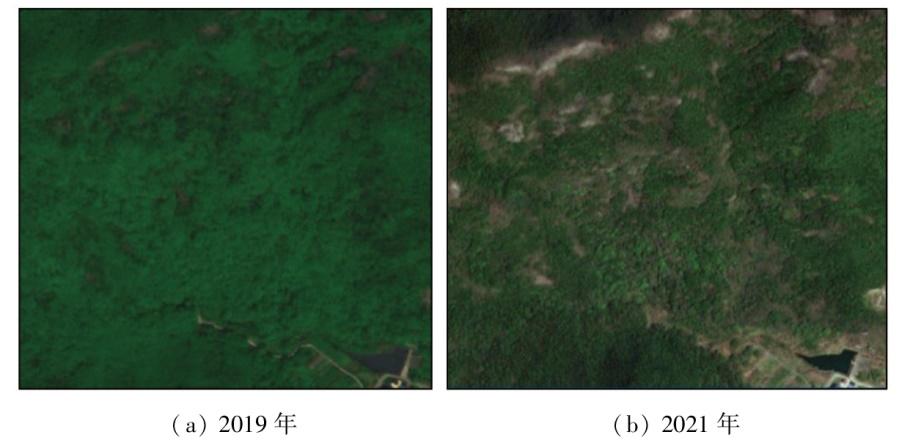
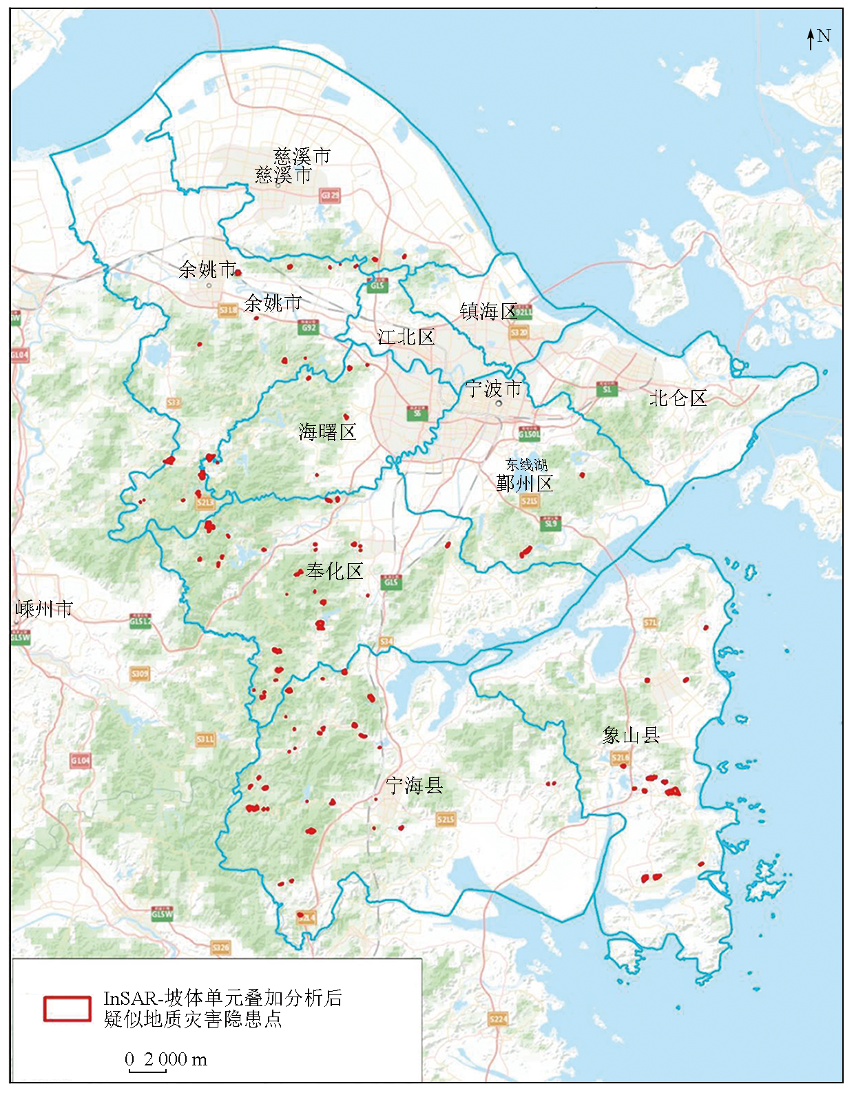
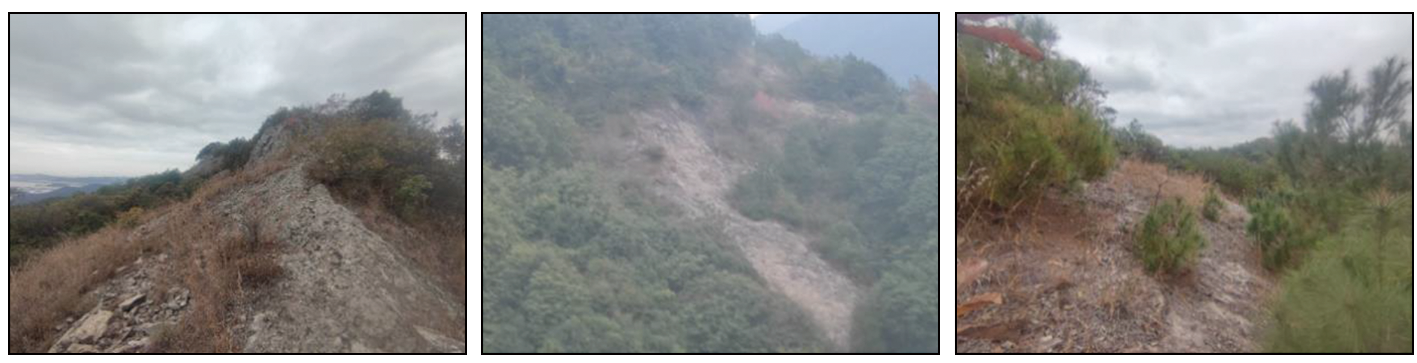
浙江省宁波地区地处华东沿海,境内地貌类型多样、地质环境复杂,受汛期影响易引发滑坡、崩塌、泥石流等地质灾害,开展宁波地区地表形变监测研究对地质灾害防治具有重要意义。该研究通过将干涉雷达(interferometric synthetic aperture radar, InSAR)、高分辨率光学影像、无人机激光雷达(light detection and ranging, LiDAR)等多种遥感手段相结合,对宁波地区开展综合遥感滑坡地质灾害监测,获得潜在地质灾害隐患点分布信息,并提取典型高风险坡体的灾害隐患点详细位置与坡体形态细节信息。该研究采用的永久散射体与分布式散射体联合构网的时序雷达干涉(combined-multi-temporal InSAR, CMT-InSAR)方法,有效增加了植被覆盖丘陵地貌条件下的高相干点密度,提高了形变监测的覆盖度和精准度。实验结果表明,宁波地区整体地表较为平稳,局部沿海区域因填海建设等活动导致地表形变较大,沉降速率超过-20 mm/a。在山区,高风险点位主要集中在奉化区、宁海县、余姚市和象山县,部分区域地表年均形变速率达到-20~-7 mm/a,且形变反演结果与野外实地考察情况一致。该研究为山区丘陵地貌的地质灾害早期识别与监测提供了一套高精度、多层次、长周期的监测手段。
高峰 , 张弘怀 , 周伟 , 王星星 , 孙丽影 , 许文新 , 吴迪 . 浙江省宁波地区地质灾害隐患点遥感综合监测识别[J]. 自然资源遥感, 2025 , 37(6) : 263 -274 . DOI: 10.6046/zrzyyg.2024246
Ningbo, located in Zhejiang Province along the eastern coast of China, features diverse landforms and a complex geological environment. It is prone to geological hazards such as landslides, rockfalls, and debris flows, particularly during the flood season. Therefore, it is of great importance to conduct surface deformation monitoring in Ningbo for geological hazard prevention and control. This study integrated multiple remote sensing methods, including interferometric synthetic aperture radar (InSAR), high-resolution optical imagery, and unmanned aerial vehicle-based light detection and ranging (LiDAR). On this basis, landslide hazard monitoring was conducted in Ningbo using comprehensive remote sensing, obtaining the distribution of potential geological hazard sites, from which detailed locations and morphological information of typical high-risk slopes were extracted. Moreover, this study employed a combined-multi-temporal InSAR (CMT-InSAR) method, which integrated permanent and distributed scatterers to form a network. This method effectively increased the density of high-coherence points under vegetated hilly conditions, enhancing the coverage and accuracy of deformation monitoring. As indicated by the experimental results, Ningbo exhibited an overall stable land surface. However, local coastal areas showed significant surface deformation due to activities such as land reclamation, with a subsidence rate exceeding -20 mm/a. In mountainous areas, high-risk sites were primarily concentrated in the Fenghua District, Ninghai County, Yuyao City, and Xiangshan County, with some areas featuring annual average surface deformation rates ranging from -20 to -7 mm/a. The deformation inversion results aligned with field survey observations. This study proposes a high-precision, multi-level, and long-term approach for the early identification and monitoring of geological hazards in mountainous and hilly areas.
表1 Radarsat-2数据信息表Tab.1 Radarsat-2 data information |
| 成像时间 (UTC) | 2020-07-21; 2020-08-14; 2020-09-07; 2020-10-01; 2020-10-25; 2020-11-18; 2020-12-12; 2021-01-05; 2021-01-29; 2021-02-22; 2021-03-18; 2021-04-11; 2021-05-05; 2021-05-29; 2021-06-22; 2021-08-09; 2021-09-26; 2021-10-20; 2021-12-07; 2021-12-31; 2022-01-24; 2022-02-17; 2022-03-13; 2022-04-30; 2022-05-24; 2022-06-17; 2022-08-04; 2022-08-28; 2022-09-21; 2022-10-15; 2022-12-02; | ||
| 影像覆盖范围 | 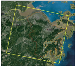 | ||
| 升降轨 | 降轨 | 分辨率/m | 5 |
| 模式 | Extra Fine超宽精细模式 | 极化方式 | VV |
| 幅宽/(km×km) | 125×125 | 处理级别 | SLC(单视 复数图像) |
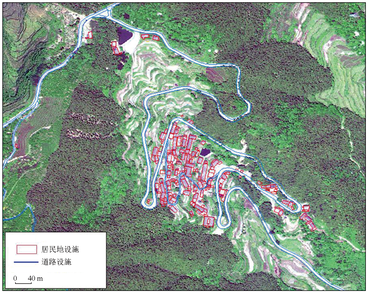
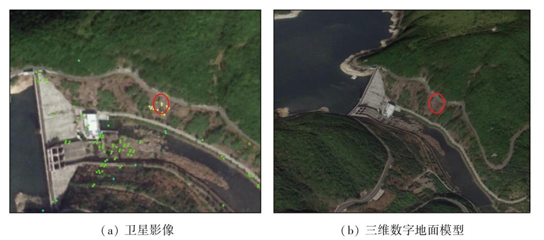
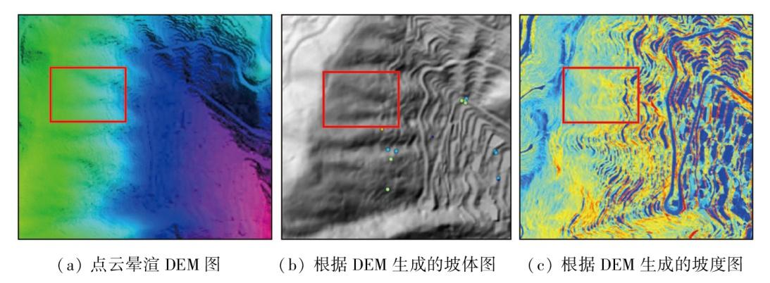
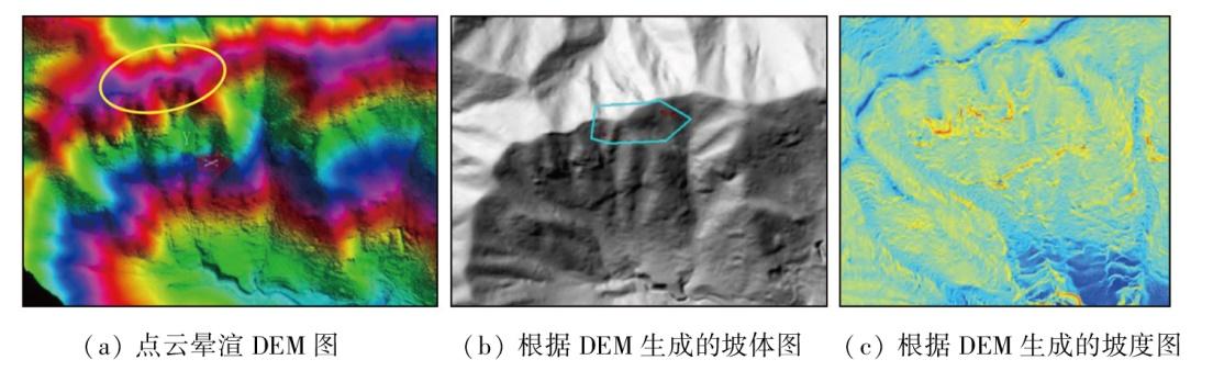
图12 野外核查形变点在卫星影像与三维数字地面模型上的位置示意图Fig.12 Schematic diagram of deformation points for field verification on satellite image and DEM |
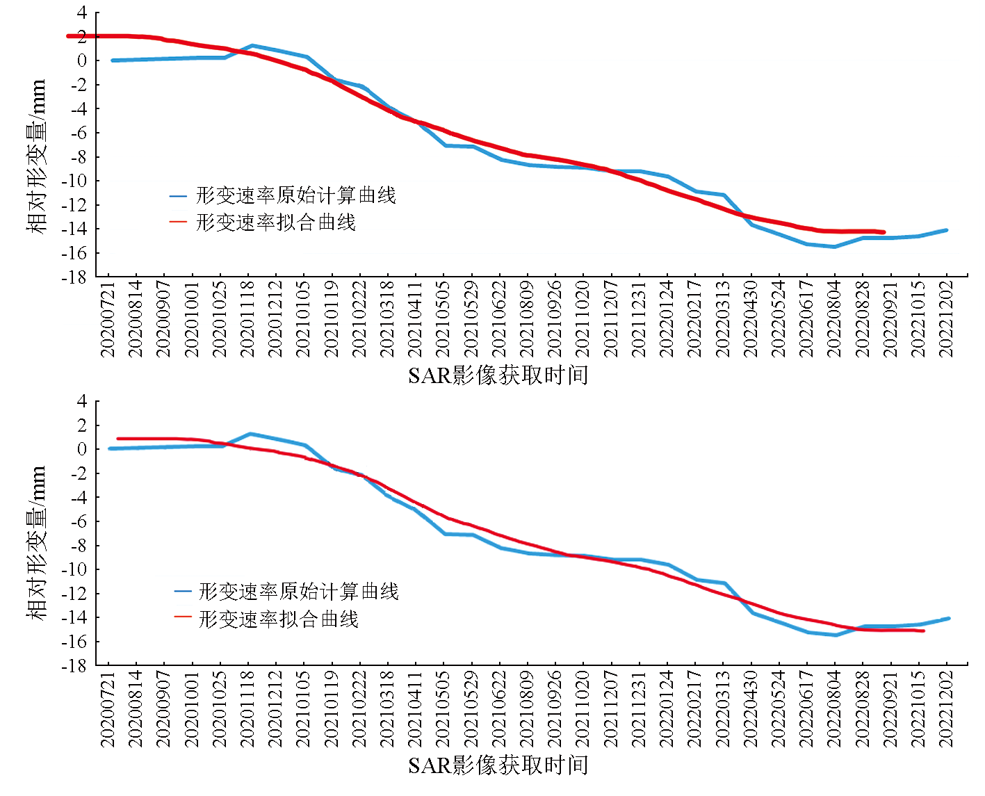
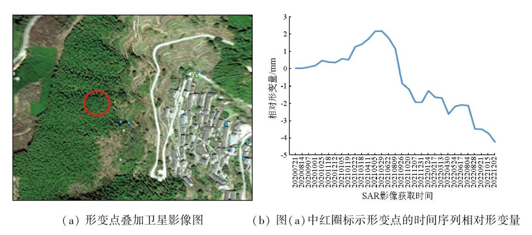
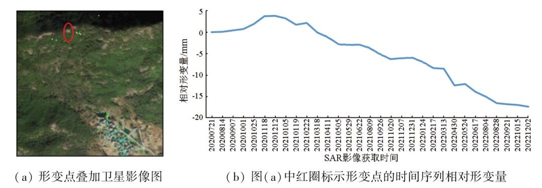
图16 宁海县陈家坑村典型形变点的时间序列相对形变量示意图Fig.16 Temporal sequence of relative deformation magnitude of the point marked by red circles in figure(a) in Chenjiakeng Village, Ninghai County |
| [1] |
自然资源部. 2024年全国地质灾害防治工作要点[EB/OL]. (2024-04-03)[2024-07-15].https://www.gov.cn/zhengce/zhengceku/202404/content_6944142.htm.
Ministry of Natural Resources. Key tasks for national geological disaster prevention and control in 2024[EB/OL].(2024-04-03)[2024-07-15].https://www.gov.cn/zhengce/zhengceku/202404/content_6944142.htm.
|
| [2] |
|
| [3] |
王庆国, 赵海, 李健平. 地面激光点云与航空影像相结合的滑坡监测[J]. 测绘通报, 2019(4): 99-102.
|
| [4] |
赵瑞英. 三维激光扫描技术在滑坡检测中的应用研究[D]. 兰州: 兰州交通大学, 2017.
|
| [5] |
|
| [6] |
|
| [7] |
|
| [8] |
|
| [9] |
许强, 董秀军, 李为乐. 基于天-空-地一体化的重大地质灾害隐患早期识别与监测预警[J]. 武汉大学学报(信息科学版), 2019, 44(7): 957-966.
|
| [10] |
葛大庆, 戴可人, 郭兆成, 等. 重大地质灾害隐患早期识别中综合遥感应用的思考与建议[J]. 武汉大学学报(信息科学版), 2019, 44(7): 949-956.
|
| [11] |
|
| [12] |
宁波市自然资源和规划局. 宁波地质灾害防治十四五规划[EB/OL].(2021-08-09)[2024-07-15].https://fgw.ningbo.gov.cn/art/2021/8/9/art_1229547556_58942159.html.
Ningbo Municipal Bureau of Natural Resources and Planning. Ningbo Geological Disaster Prevention and Control 14th Five-Year Plan[EB/OL].(2021-08-09)[2024-07-15].https://fgw.ningbo.gov.cn/art/2021/8/9/art_1229547556_58942159.html.
|
| [13] |
|
| [14] |
|
| [15] |
|
| [16] |
|
/
| 〈 |
|
〉 |