
轻型无人机在矿产卫片执法中的数据采集及应用研究
|
陈栋(1994-),男,硕士,工程师,主要从事矿山开发修复遥感与信息化技术相关研究。Email: winkies@126.com。 |
Office editor: 李瑜
收稿日期: 2023-12-22
修回日期: 2024-04-07
网络出版日期: 2026-06-03
基金资助
中国地质调查局地质调查项目“全国矿山开发及重点地区生态空间监测评估”(102202220120000009066)
Data acquisition and application of lightweight unmanned aerial vehicles in satellite image-based law enforcement for minerals
Received date: 2023-12-22
Revised date: 2024-04-07
Online published: 2026-06-03
陈栋 , 杨金中 , 汪洁 , 刘琼 , 赵玉灵 , 李相宜 . 轻型无人机在矿产卫片执法中的数据采集及应用研究[J]. 自然资源遥感, 2025 , 37(3) : 162 -169 . DOI: 10.6046/zrzyyg.2023396
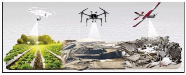
In satellite image-based law enforcement for minerals, using unmanned aerial vehicles (UAVs) for investigation and aerial photography in mining areas with complex geographic conditions and unknown staffing situations, and photogrammetry for three-dimensional modeling of mining areas serves as an effective means to ensure the personal safety of field workers and improve work efficiency and accuracy. Lightweight UAVs are more applicable to satellite image-based law enforcement for highly mobile minerals due to their flexible take-off and landing conditions and high maneuverability while ensuring shooting clarity and modeling data requirements. Based on the UAV aerial survey results of several mining faces in Liaoning Province, this study demonstrates that satellite image-based law enforcement for minerals assisted by lightweight UAVs can significantly improve the efficiency and safety of fieldwork. Moreover, the modeling results provide data support for subsequent accurate survey and analysis and multi-temporal monitoring in mining areas.
表1 大疆御2Pro主要参数Tab.1 Main parameters of DJI Mavic 2 Pro |
| 参数 | 数值 |
|---|---|
| 尺寸(折叠)/mm | 214×91×84(长×宽×高) |
| 尺寸(展开)/mm | 322×242×84(长×宽×高) |
| 对角线轴距/mm | 354 |
| 最大水平飞行速度(海平面附近无风)/(km·h-1) | 72(S模式) |
| 最大起飞海拔/m | 6 000 |
| 最长飞行时间(无风环境)/min | 31(25 km/h匀速飞行) |
| 最长悬停时间(无风环境)/min | 29 |
| 最大续航里程(无风环境)/km | 18(50 km/h匀速飞行) |
| 最大抗风等级 | 5级 |
| 起飞质量/g | 907 |
| 影像传感器 | 1英寸CMOS |
| 有效像素 | 2 000万 |
| 镜头视角/(°) | 77 |
| 等效焦距/mm | 28 |
表2 各取证方式时间对比Tab.2 Time comparison of different methods(min) |
| 现场 | 无人机飞行 | |||
|---|---|---|---|---|
| 拍照 | 视频建模 | 正射影像建模 | 倾斜摄影建模 | |
| 12.6 | 3.7 | 5.3 | 9.1 | 43.5 |
表3 各取证方式取证效果对比Tab.3 Effect comparison of different methods |
| 取证方式 | 现场 | 无人机飞行 | |||
|---|---|---|---|---|---|
| 拍照 | 视频建模 | 正射影像建模 | 倾斜摄影建模 | ||
| 无证开采 取证 | 中 | 中 | 优 | 优 | 优 |
| 越界开采 取证 | 差 | 中 | 良 | 优 | 优 |
| [1] |
王甲乙, 侯照亮, 蔡全胜, 等. 无人机在露天金矿区地质填图中的应用[J]. 黄金, 2022, 43(10):4-10.
|
| [2] |
崔宏兵, 焦殿阳. 无人机三维建模在矿山执法检查工作中的应用[J]. 测绘与空间地理信息, 2023, 46(7):164-166.
|
| [3] |
陈浩. 深析无人机测绘技术在矿山监测中的应用研究[J]. 中国金属通报, 2022(9):174-176.
|
| [4] |
宋铁军. 矿山治理工作中应用无人机倾斜摄影测量技术的方法[J]. 中国金属通报, 2023(3):134-136.
|
| [5] |
王凯, 王莹, 常勤慧. 无人机倾斜摄影测量在矿山监测中的应用策略分析——以河南A矿山为例[J]. 装备制造技术, 2023(5):240-243.
|
| [6] |
向杰, 陈建平, 李诗, 等. 无人机遥感技术在北京首云铁矿储量动态监测中的应用[J]. 国土资源遥感, 2018, 30(3):224-229.doi: 10.6046/gtzyyg.2018.03.30.
|
| [7] |
王珏, 郭振, 张志卫, 等. 基于倾斜摄影测量的三维景观指数构建——以山东田横岛为例[J]. 自然资源遥感, 2023, 35(2):112-121.doi: 10.6046/zrzyyg.2022163.
|
| [8] |
|
| [9] |
闫驰, 焦润成, 曹颖, 等. 无人机倾斜摄影在泥石流灾害识别分析中的应用——以北京房山区史家营曹家坊泥石流为例[J]. 国土资源遥感, 2020, 32(4):251-257.doi:10.6046/gtzyyg.2020.04.31.
|
| [10] |
|
| [11] |
李建强. 基于无人机技术的金属矿山地形测绘方法[J]. 中国金属通报, 2023(2):207-209.
|
| [12] |
王海成, 温富春, 杨胜兵, 等. 无人机三维扫描实景建模技术的应用探讨[J]. 中文科技期刊数据库(全文版)自然科学, 2023(9):76-78.
|
| [13] |
卜全民, 赵小乔, 李涛. 无人机倾斜摄影三维实景建模及其优化技术研究[J]. 江苏警官学院学报, 2022, 37(3):122-128.
|
| [14] |
张明明. 矿山测量中无人机测绘技术的应用探讨[J]. 世界有色金属, 2023(7):22-24.
|
| [15] |
宋增巡. 矿山测量中无人机航测系统的应用分析[J]. 矿业装备, 2023(3):186-187.
|
| [16] |
唐小明. 无人机航测系统在地质测绘领域的实践探索[J]. 四川建材, 2021, 47(12):43-44.
|
| [17] |
侯中伟, 张昭云. 无人机航测在矿山测绘中的运用分析[J]. 世界有色金属, 2018(5):35,37.
|
| [18] |
张登波, 钱玉国. 无人机航摄系统及其在矿山执法中的应用[J]. 江西测绘, 2015(4):45-46.
|
| [19] |
樊冠嵩. 无人机航摄在矿山测绘中的应用研究[J]. 信息化建设, 2016(6):341.
|
/
| 〈 |
|
〉 |