
Prediction of the ecological and water diversion impacts of the channel evolution of the Tarim River mainstream from Yingbazha to Wusiman on both banks
Received date: 2025-01-09
Revised date: 2025-02-16
Online published: 2026-03-11
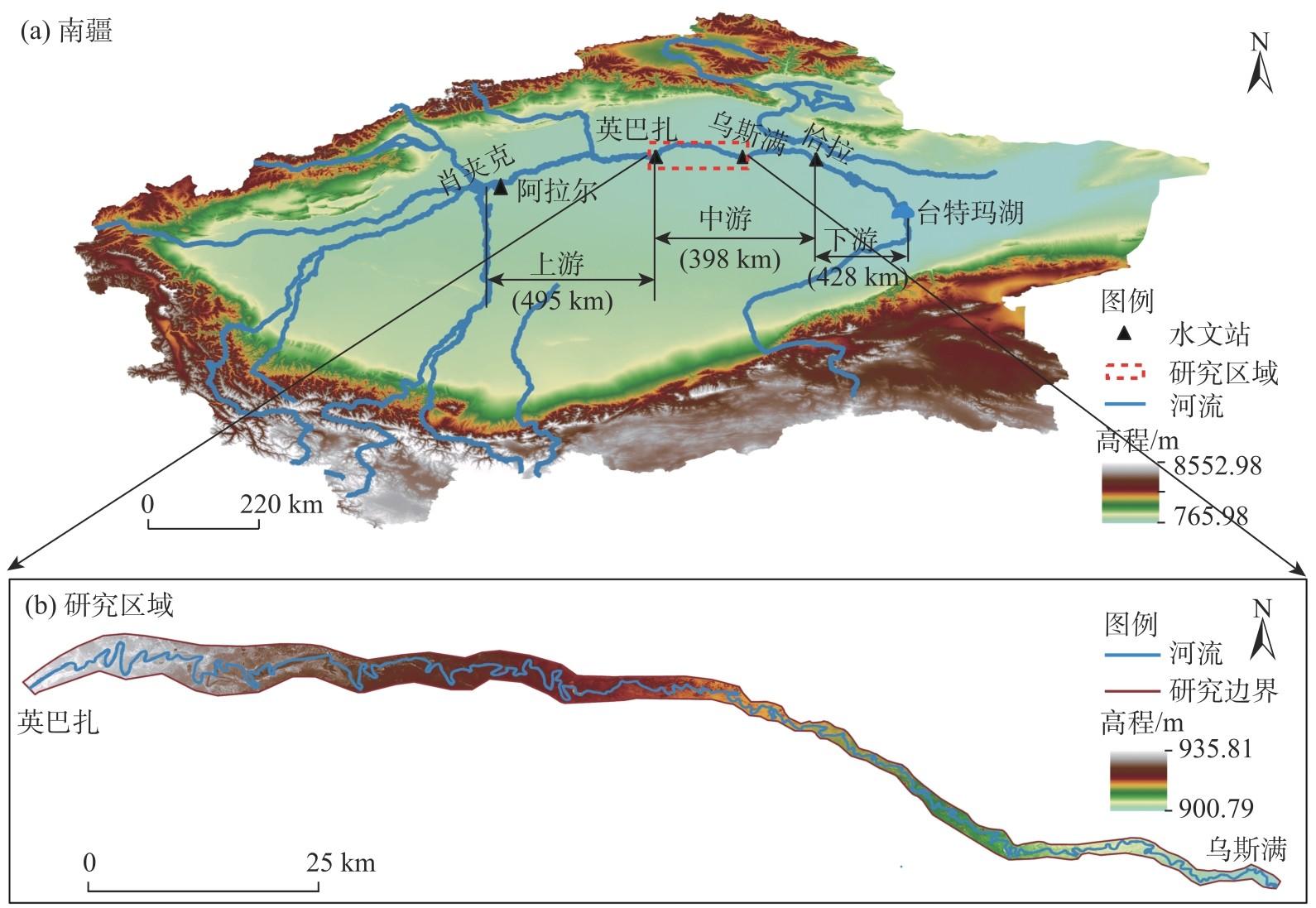
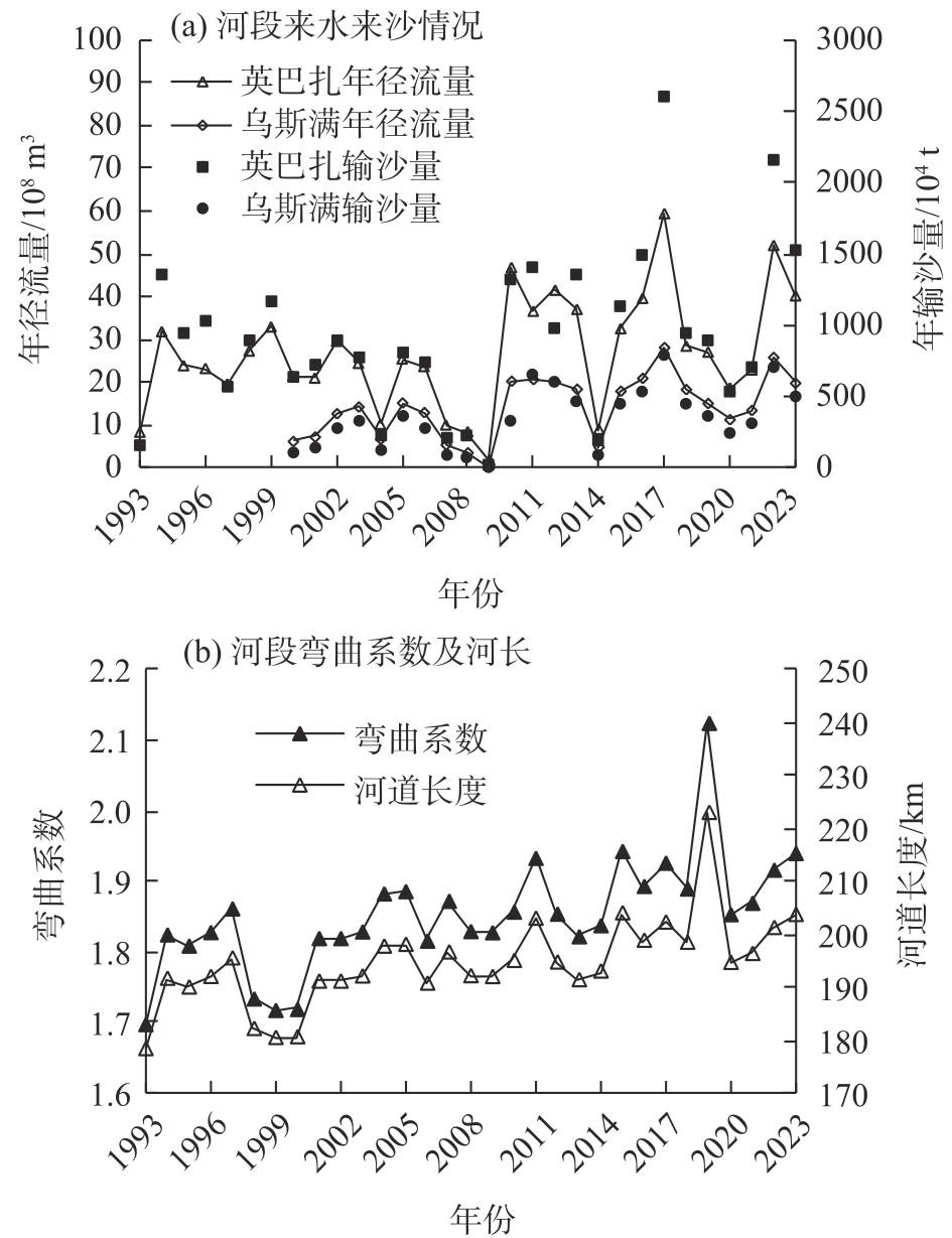
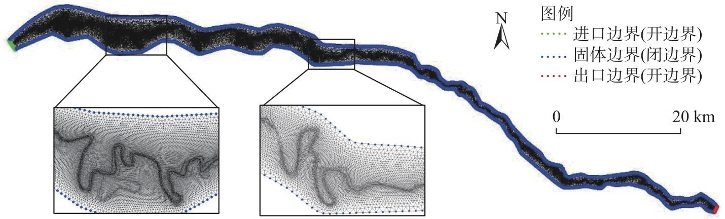
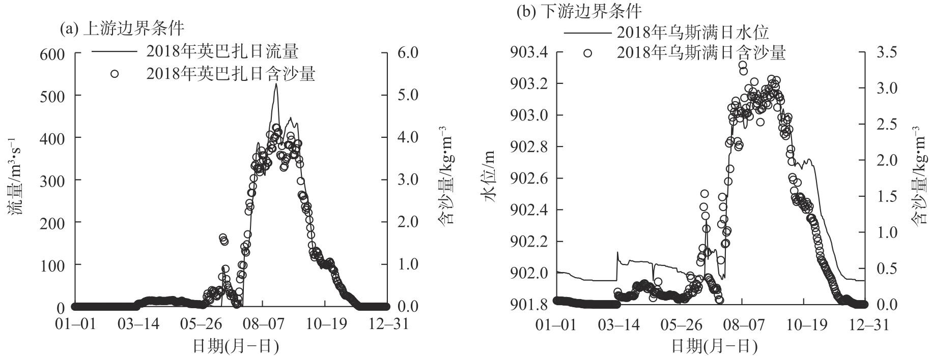
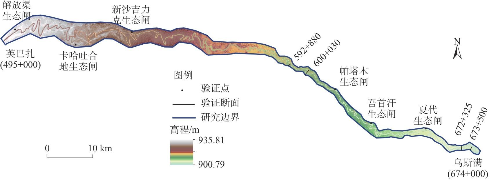
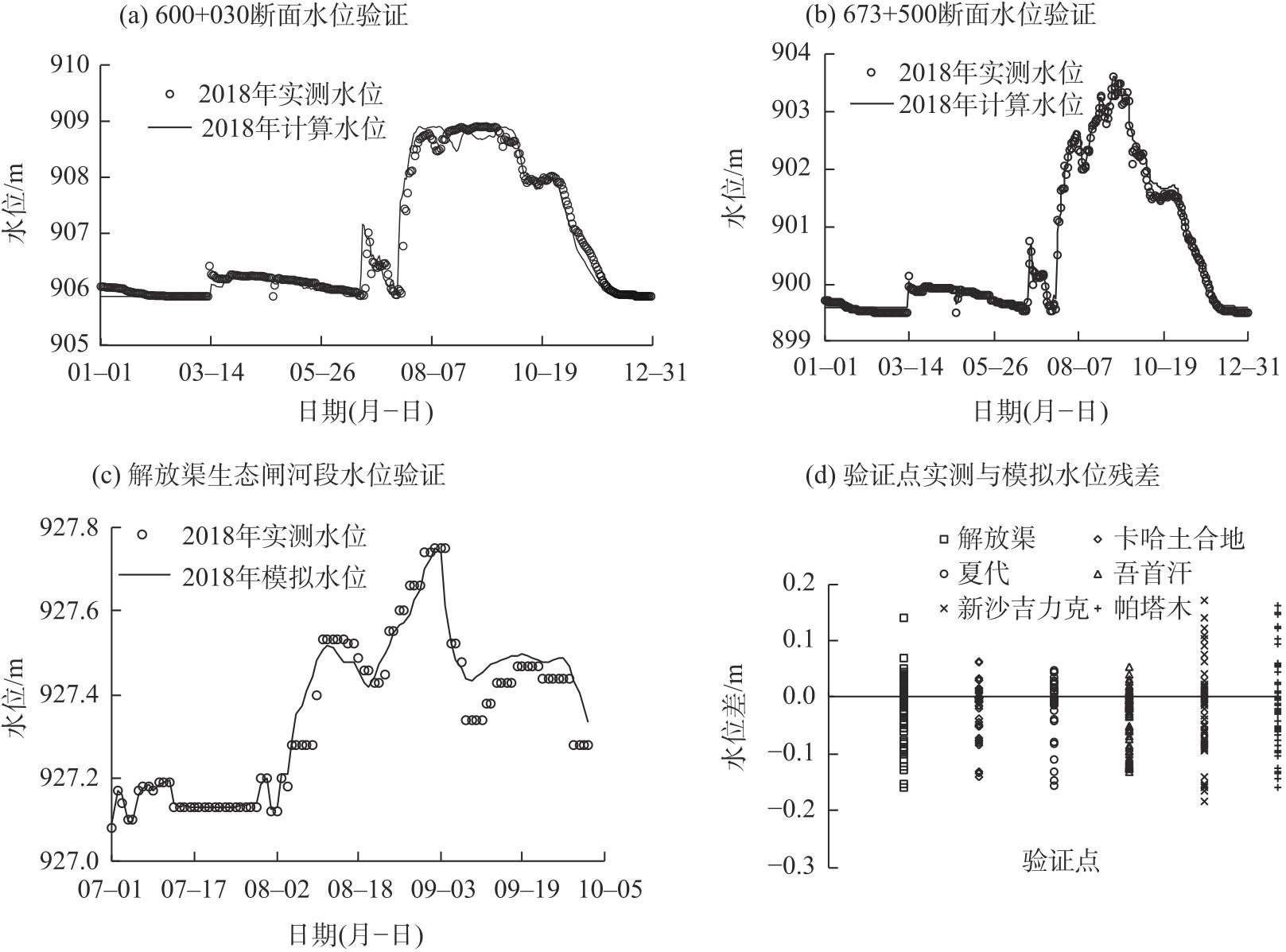
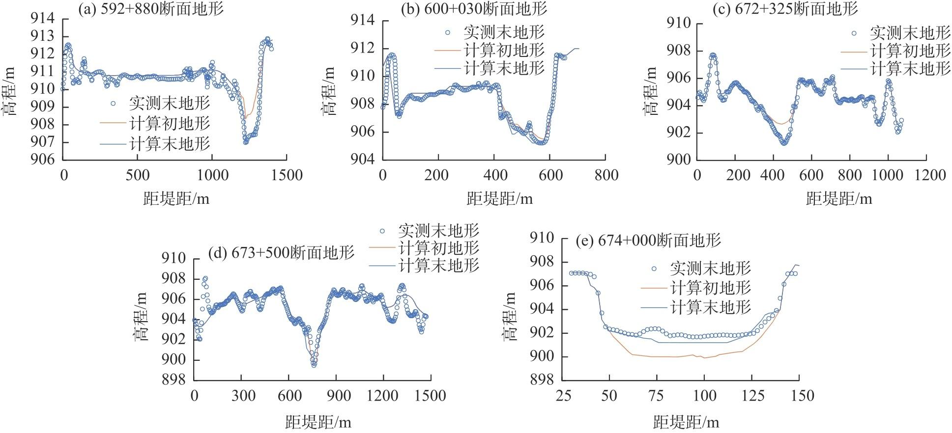
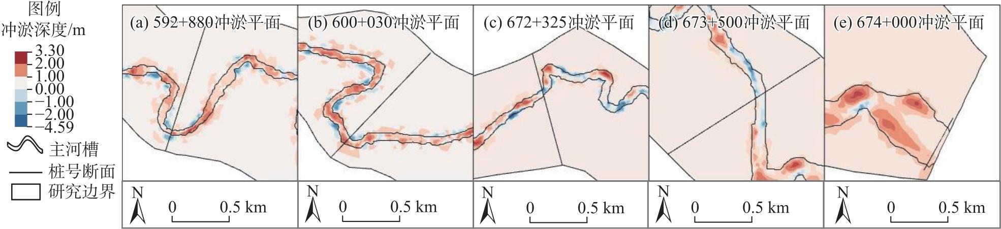
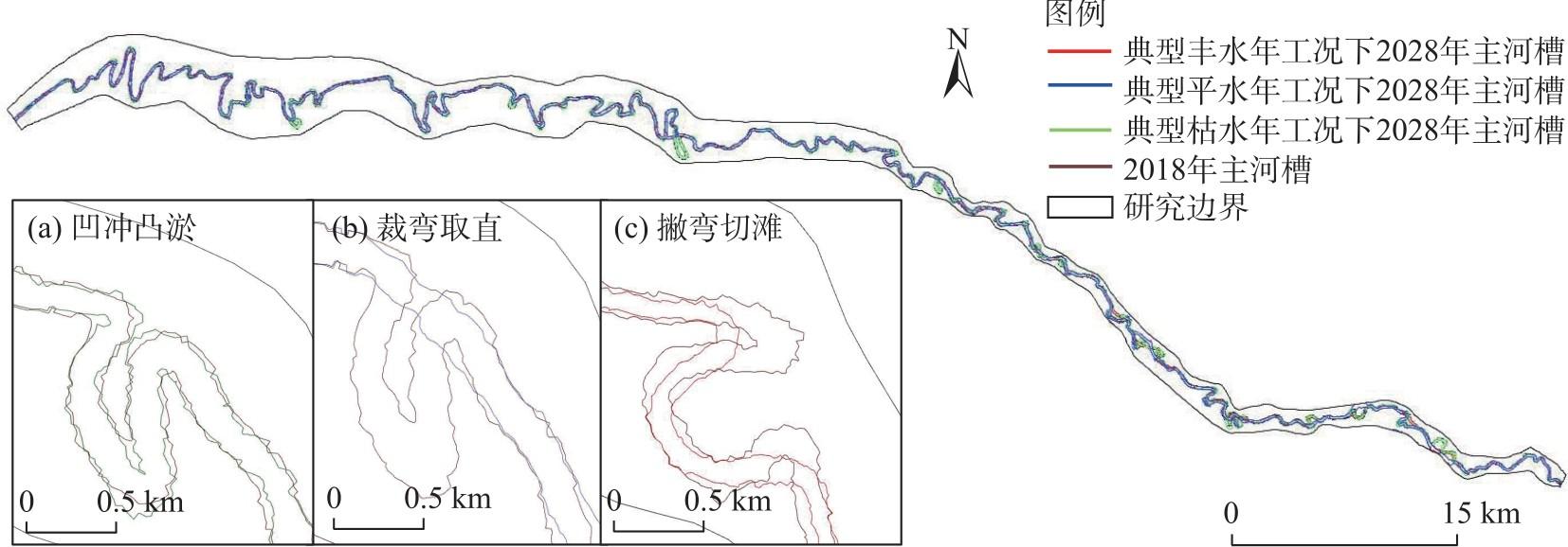
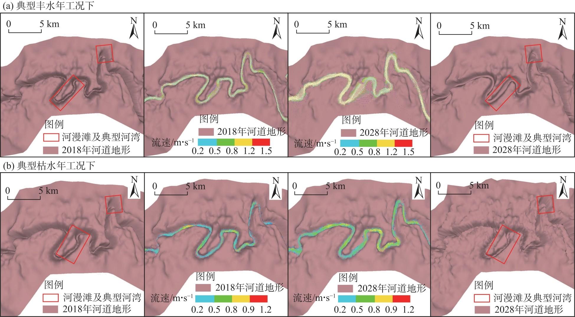
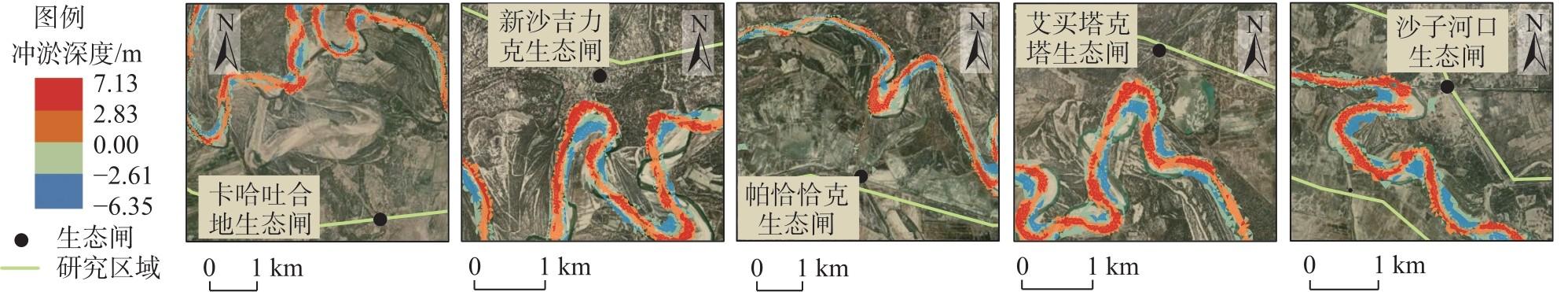
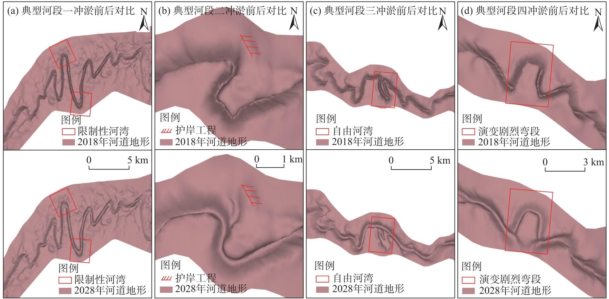
To investigate the impacts of river-channel erosion and deposition evolution on the ecological sluice gates and water diversion outlets along the middle reaches of the Tarim River mainstream, Xinjiang, China, a fluvial process model of the Yingbazha-Wusiman reach under the 2018 shoreline conditions was established and validated in MIKE21 software. Incorporating the geomorphic acceleration factors, the model simulated the decadal channel evolution under varying water-sediment conditions under five hydrological scenarios (wet, normal, dry, extreme flood, and extreme drought years). The results indicate th following: (1) Significant differences in the river-regime evolution processes under different water and sediment conditions. (2) Diversion-inlet siltation, bend cutoff and bank erosion, channel straightening through meander truncation, and river course realignment in certain river regions during exceptionally heavy flood years and typical high-flow years. In particular, the scour and silting evolution intensifies with increasing incoming water and sediment volumes. The river channel is characterized by meandering paths at low water levels and straighter paths at high water levels. Meanwhile, the morphological changes under high-flow conditions have increased the operational difficulty of diverting the water through the ecological sluice gates, sometimes leading to complete water-diversion failure. For instance, when the siltation elevation at the Kahatuhedi sluice exceeded the maximum flood level by 0.71 m, the water diversion was completely blocked and the ecological water supply to the right bank was compromised. Flow-direction changes in the Yilanlike sluice also threatened the right bank embankments. In dry scenarios, the channel sinuosity increased by 6.8% (to a total length of 212.05 km), albeit with less dramatic morphological changes than in wet years. (3) To maintain the functionality of water diversion, the authors recommend proactive regulatory measures that prevent inlet siltation and bend instability in bend segments containing sluices, particularly in free meanders. These findings enhance our understanding of erosion-deposition trends in meandering reaches of the Tarim River mainstream, providing scientific guidance for future management and sustainable development of the middle reach.
Jiuzhou GAO , Lin LI . Prediction of the ecological and water diversion impacts of the channel evolution of the Tarim River mainstream from Yingbazha to Wusiman on both banks[J]. Arid Land Geography, 2025 , 48(10) : 1771 -1782 . DOI: 10.12118/j.issn.1000-6060.2025.018
表1 不同工况水沙情况Tab. 1 Water and sediment conditions under different working conditions |
| 工况 | 年径流量/108 m3 | 年输沙量/104 t |
|---|---|---|
| 特大洪水年 | 59.47 | 2602.58 |
| 典型丰水年 | 37.07 | 1363.99 |
| 典型平水年 | 28.46 | 950.40 |
| 典型枯水年 | 10.02 | 228.12 |
| 极端枯水年 | 1.83 | 22.32 |
表2 研究区域河长及弯曲系数Tab. 2 River lengths and curvature coefficients of the study area |
| 工况 | 模拟后弯曲系数 | 模拟后河长/km |
|---|---|---|
| 特大洪水年 | 1.66 | 174.36 |
| 典型丰水年 | 1.74 | 183.08 |
| 典型平水年 | 1.88 | 198.21 |
| 典型枯水年 | 2.02 | 212.05 |
| 极端枯水年 | 1.99 | 209.48 |
表3 典型丰水年工况下生态闸引水情况Tab. 3 Ecological sluice water diversion table under typical wet year conditions |
| 闸门名称 | 2018年 | 引水情况 | 2028年 | 引水情况 | ||
|---|---|---|---|---|---|---|
| 河道水位/m | 淤积体高程/m | 河道水位/m | 淤积体高程/m | |||
| 卡哈吐合地 | 927.82 | 923.13 | 正常引水 | 928.29 | 929.00 | 不能引水 |
| 新沙吉力克 | 925.23 | 921.06 | 正常引水 | 926.34 | 924.69 | 引水困难 |
| 艾买塔克塔 | 921.60 | 916.25 | 正常引水 | 923.43 | 921.24 | 引水困难 |
| 帕恰恰克 | 923.67 | 919.54 | 正常引水 | 925.56 | 924.51 | 引水困难 |
| 沙子河口 | 918.15 | 914.70 | 正常引水 | 919.65 | 918.42 | 引水困难 |
| [1] |
李玉建, 侍克斌, 严新军. 塔里木河干流泥沙治理途径初探[J]. 人民黄河, 2005, 27(1): 26-27.
[
|
| [2] |
王延贵, 胡春宏, 周文浩, 等. 塔里木河干流的河床演变特点[J]. 水利学报, 2003(12): 27-33.
[
|
| [3] |
郭庆超, 王新平, 周军, 等. 塔里木河干流近期治理后水沙运动规律研究[M]. 北京: 中国水利水电出版社, 2016: 13-54.
[
|
| [4] |
胡春宏, 王延贵. 塔里木河干流河道综合治理措施的研究(Ⅰ)——干流河道演变规律[J]. 泥沙研究, 2006(4): 21-29.
[
|
| [5] |
胡春宏, 王延贵. 塔里木河干流河道综合治理措施的研究(Ⅱ)——干流河道整治与生态输水措施[J]. 泥沙研究, 2006(4): 30-38.
[
|
| [6] |
高久洲, 李琳, 戴文鸿, 等. 基于数字岸线系统分析塔里木河英巴扎至乌斯满河道演变特性[J]. 泥沙研究, 2024, 49(5): 42-49.
[
|
| [7] |
王鑫淼, 魏炳乾, 白涛, 等. 塔里木河下游弯曲河道形态特征及演变分析[J]. 泥沙研究, 2023, 48(2): 37-43.
[
|
| [8] |
|
| [9] |
|
| [10] |
|
| [11] |
|
| [12] |
祁泓锟, 焦菊英, 严晰芹, 等. 近40年塔里木河流域水沙演变及其空间分异特征[J]. 水土保持研究, 2022, 29(5): 117-123.
[
|
| [13] |
贺兴宏, 管瑶. 塔里木河干流河道演变对两岸生态环境的影响研究[J]. 干旱区资源与环境, 2011, 25(1): 59-62.
[
|
| [14] |
王光焰, 王远见, 桂东伟. 塔里木河流域水资源研究进展[J]. 干旱区地理, 2018, 41(6): 1151-1159.
[
|
| [15] |
徐乐, 牧振伟, 李园园, 等. 基于CCHE模型的乌斯满引水枢纽水流数值模拟[J]. 水资源与水工程学报, 2015, 26(5): 172-176.
[
|
| [16] |
李园园, 牧振伟, 徐乐, 等. 塔里木河流域乌斯满河段平面二维水沙数值模拟[J]. 水电能源科学, 2015, 33(10): 72-75, 96.
[
|
| [17] |
郭庆超, 陆琴, 张玉江, 等. 塔里木河干流河道水沙数学模型及其应用[J]. 泥沙研究, 2015(3): 1-7.
[
|
| [18] |
奚秀梅, 段树国, 海米提·依米提. 塔里木河中游径流变化分析[J]. 水土保持研究, 2006, 13(2): 115-117.
[
|
| [19] |
杨涵苑, 李志威, 余国安. 塔里木河干流弯曲河段维持蜿蜒的必要条件[J]. 泥沙研究, 2018, 43(2): 47-54.
[
|
| [20] |
邬晓丹, 罗敏, 孟凡浩, 等. 塔里木河“四源”洪水演变规律及成因分析[J]. 干旱区地理, 2024, 47(1): 15-27.
[
|
| [21] |
王远见, 董其华, 周海鹰. 塔里木河干流上游洪水演进规律分析与数值模拟[J]. 干旱区地理, 2018, 41(6): 1143-1150.
[
|
| [22] |
俞茜, 陈永灿, 朱德军, 等. 基于DEM数据的河道水动力过程数值模拟[J]. 水力发电学报, 2014, 33(3): 133-137.
[
|
| [23] |
渠庚, 郭小虎, 朱勇辉. 三峡水库下游河道演变机理与治理对策[M]. 北京: 中国水利水电出版社, 2021: 128-174.
[
|
| [24] |
陈宇. 塔里木河干流英巴扎水文站径流特性分析[J]. 地下水, 2023, 45(2): 233-235.
[
|
| [25] |
郭磊城, 何青,
[
|
| [26] |
翟新博. 塔里木河中游河势演变分析[J]. 四川水利, 2021, 42(3): 129-131.
[
|
/
| 〈 |
|
〉 |